Happy first day of summer! It starts at 4:51 this afternoon but of course we don’t need the calendar to tell us summer is here, it’s felt like it this week and will again today.
Temperatures today will be similar to yesterday as we soar into the 90s once again. Factor in the humidity and we’ll feel like 97-107° this afternoon.
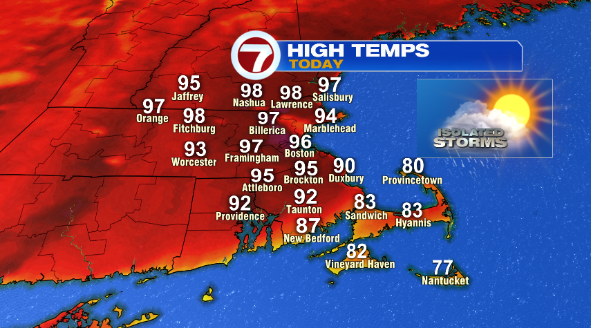
In the least shocking news of the day, everyone (aside from the Cape) hit 90° yesterday afternoon so we completed day 2 of our heat wave with day 3 on the way for today and the first heat wave of the year.
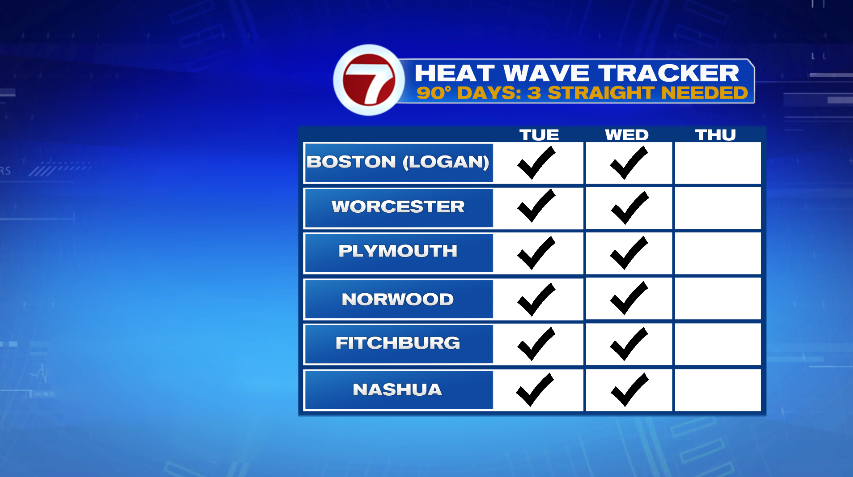
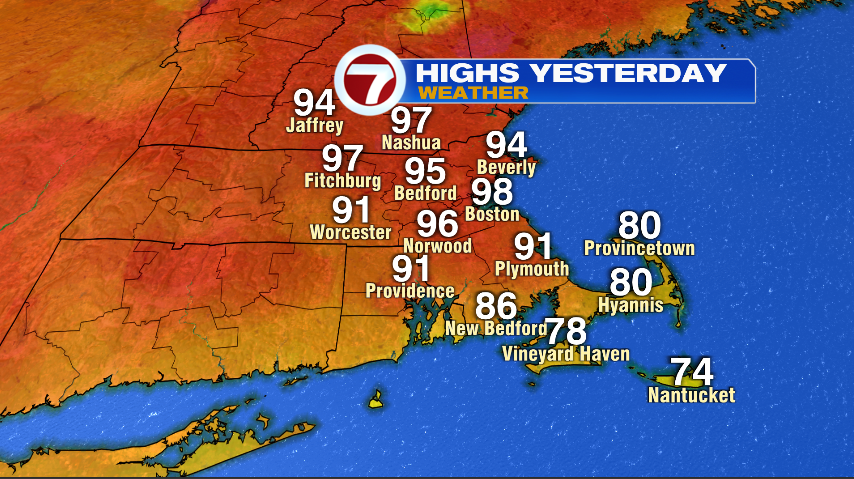
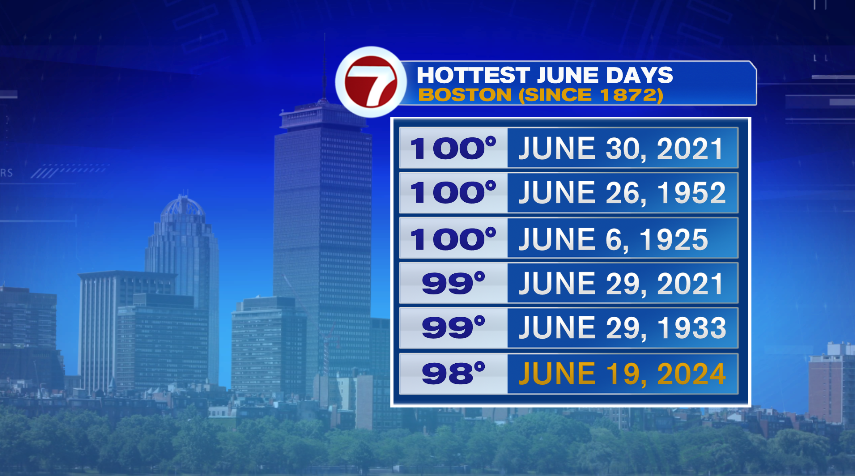
In fact, Boston’s high of 98° was good enough to break a record yesterday for the day. The high of 98° also put us on the list of hottest June days on record for Boston. Records go back to 1872 with three of the top six happening in just the last three years.
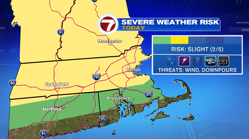
Today with the heat and humidity we’ll again bring the chance of a few showers and thunderstorms back to the forecast. Like yesterday, with the heat and humidity any of the storms that do fire up have the potential to be strong or severe. We’re under a slight risk of severe weather (that’s a level 2 of 5 on the severe weather scale) with our main risks being damaging wind gusts, lightning, and with tropical humidity… tropical downpours.
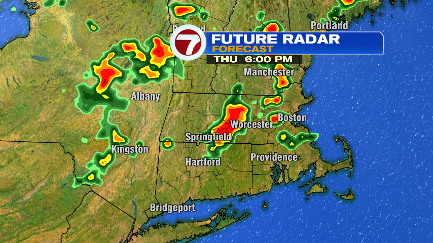
We’ll be dry for the morning hours today with the storms popping up through the afternoon and evening. It’s one of those situations where not everyone sees a storm, but if you do, you’ll know it! With the heavy rain and gusty winds — possibly even damaging and severe level wind gusts.
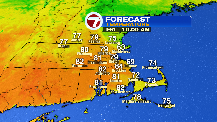
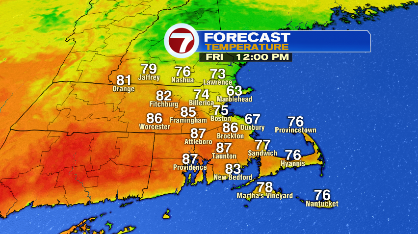
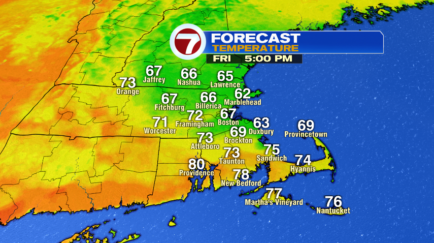
All eyes on the Friday forecast for several reasons… we celebrate the Celtics with the rolling rally in Boston and the heat finally breaks! Now, if you head out to get a spot along the parade route, or just heading out for work tomorrow morning, it’ll be a warm and humid start just like the last few mornings. We’ll start in the 70s and make a quick run to 80° just like the last few mornings. Then by late morning and afternoon we’ll head a different direction. Instead of a hot southwest wind blowing in hot air all day long, we’ll flip the wind to the northeast and that onshore wind will give us the much needed relief we’ve been waiting for. So by early afternoon Boston and the coast will fall back through the 70s. Inland spots will take a little longer to get into that cooler air, but it’ll still be a cooler day, topping out in the 80s in the afternoon then falling in the evening.
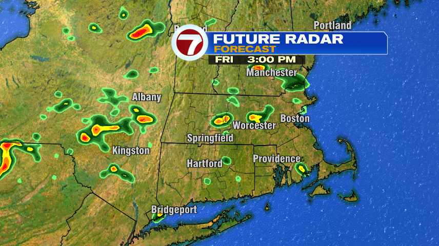
We’ll also keep the isolated storm chance around for Friday too. For the parade, I think we’ll be fine. By the tail end we may start to pop up a few showers or storms. They’re still isolated, nowhere near widespread and the good news is I think we can take out the severe risk for Friday.
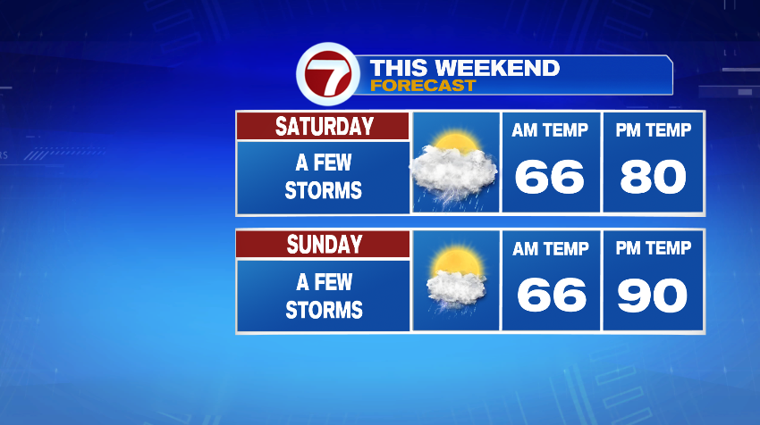
A few isolated and scattered storms stay in the forecast going forward as we hang out in an unsettled pattern. Like today, and like Friday, no day is a washout but each day over the next several will feature isolated to scattered storm chances. We get a little break from the heat on Saturday but it comes back on Sunday… kind of. We’re back to that typical summer heat, not the extreme stuff we’ve had this week.