Wildfire prevention has traditionally relied on blunt tools, such as rigid inspection cycles and emergency power shutoffs. Now a new generation of technology start-ups is pitching a more targeted approach: using artificial intelligence to help utility companies decide what to inspect—and where to intervene—before a spark becomes a blaze.
The stakes are rising. In 2025 more than 77,000 wildfires were reported in the U.S.—significantly more than the past decade’s average—and burned more than five million acres. For months at a time, firefighting resources were stretched thin. Droughts have been recurring as the climate has continued to warm, and wildfires are now almost year-round threats.
Forces ranging from weather and vegetation structure to electric grid infrastructure and human activity make wildfires difficult to predict. Overstory, an Amsterdam-based company, developed AI-powered vegetation monitoring to help utility companies identify hazard trees that are most likely to fall near power lines. The goal is to prevent sparks that might turn into wildfire.
On supporting science journalism
If you’re enjoying this article, consider supporting our award-winning journalism by subscribing. By purchasing a subscription you are helping to ensure the future of impactful stories about the discoveries and ideas shaping our world today.
It is a massive challenge. In California’s highest-risk fire areas, vegetation contact accounts for a large share of utility-caused ignitions. Combustible vegetation such as trees, grass or shrubs is the primary fuel for wildfires, and it is one of the factors that utilities have control over, says Sonya Sachdeva, a cognitive scientist at Overstory, who focuses on wildfire decision-making.
To manage vegetation, utility companies typically send crews to walk the power lines or fly helicopters periodically to collect information using lidar (light detection and ranging), a technology used to precisely map terrain with high-resolution, three-dimensional images. But both ways can be slow, expensive and inefficient.
Overstory takes a different approach. To provide a targeted map-based view, the company acquires high-resolution satellite imagery based on the locations of a utility company’s power network. It then runs a set of proprietary computer-vision models to identify tree height, encroachment, health and mortality alongside wildfire-relevant factors such as dead grasses, shrubs and moisture levels.
The goal is not to replace people but to help utility companies know where to send their crews, says Fiona Spruill, CEO of Overstory. “We’re giving our suggestions based on our analysis. But ultimately, the decisions are made by humans in the field who are standing in front of the trees,” she says.
The results are promising. One of Overstory’s clients, Pacific Gas and Electric (PG&E), saw a nearly 50 percent drop in the number of ignitions with vegetation as a suspected trigger in 2025 compared with the previous year, according to Andrew Abranches, PG&E’s vice president of wildfire mitigation.
But the tech has limits. Overstory’s data provides frequent snapshots, but it isn’t a live feed; satellite imagery still lags behind the real-time alerts of a camera network. “With any modeling endeavor, there is a certain degree of uncertainty,” Sachdeva says. “But there is always a human in the loop when we suggest something.”
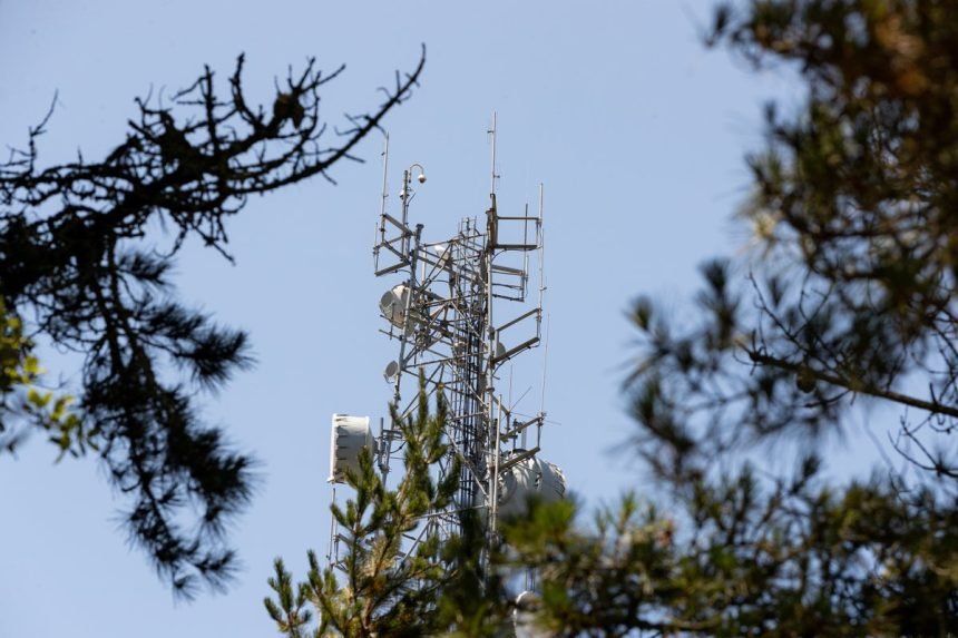
Another front in technology targeting fires, sometimes called firetech, is the push to develop AI-powered detection tools. Pano AI, a San Francisco–based wildfire detection company, designed its own pan-tilt-zoom cameras, which can scan 360 degrees to look for anomalies. Sets of images are uploaded 24/7 to its cloud-based AI monitors for daytime smoke and nighttime heat signatures, which are supplemented with additional feeds such as geostationary satellite data and information from emergency services.
AI models feed alerts to command hubs like PG&E’s Hazard Awareness Warning Center in San Ramon, California, where analysts verify threats before dispatching crews.
Jason Henry/Bloomberg via Getty Images
Experts cross-reference each AI detection with camera footage to differentiate between smoke and look-alikes such as fog, dust or clouds, says Sonia Kastner, CEO of Pano AI. “Once a human has verified that this is indeed a fire, they push out an alert by text and e-mail,” she says.
Pano AI’s partnership with Arizona Public Service (APS), Arizona’s largest utility company, has shortened fire response times over the past two years. “Pano [AI] has consistently beaten 911 callers,” says Scott Bordenkircher, APS’s forestry and fire mitigation director, and has sometimes done so by “10 to 15 to 25 minutes,” allowing firefighters to respond sooner.
Bordenkircher notes, however, that the effectiveness of AI-powered detection cameras also depends on a clear line of sight, meaning smoke must rise high enough to be visible to cameras. Detection is also limited to areas where cameras have been installed, leaving parts of Arizona without coverage.
Pano AI was built on ideas that were first explored in academic wildfire research. One of those early efforts was ALERTCalifornia, a University of California, San Diego–led public safety program that uses cameras and AI to help local fire departments confirm wildfires in real time. Neal Driscoll, ALERTCalifornia’s principal investigator, says that before AI came into play, fire detection often began with 911 calls. “You have to send a battalion to verify if the fire is real, and that takes a huge amount of time,” he says. But now, through the detection system, fires can be identified and observed even before 911 calls come in.
“We’ve cut down the response time dramatically,” Driscoll says. The hope is that the time saved will translate to smaller fires.