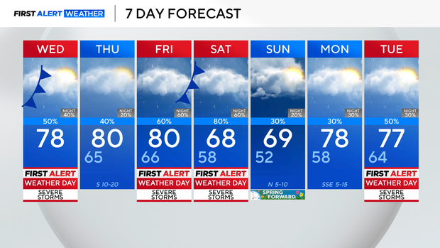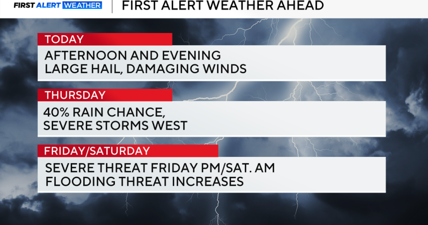
We will see severe thunderstorms Wednesday evening along a stalled frontal boundary across the metroplex. Large hail, damaging winds and an isolated tornado threat are possible.
A severe thunderstorm warning has been issued for Dallas and Tarrant counties until 7:15 p.m. Quarter-size hail and 60 mph wind gusts are possible.
A severe thunderstorm warning has been issued for Grayson County until 7:30 p.m.
A flash flood warning has been issued for Dallas, Rockwall and Tarrant counties until 8:30 p.m. The greatest flooding threat will remain across southwestern Dallas County and far southeastern Tarrant County. About 2″ of rain has already fallen, with an additional 1-2″ expected.
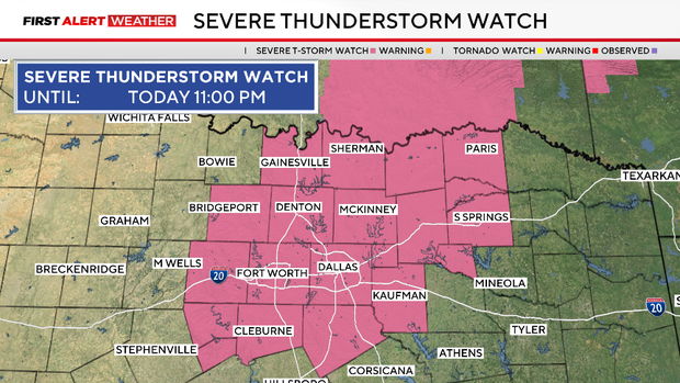
A severe thunderstorm watch has been issued until 11 p.m. for Collin, Cooke, Dallas, Delta, Denton, Ellis, Fannin, Grayson, Hood, Hopkins, Hunt, Johnson, Kaufman, Lamar, Parker, Rains, Rockwall, Somervell, Tarrant and Wise counties.
In Garland, the roof of a warehouse in the 2900 block of W. Kingsley Road near Shiloh Road collapsed under the weight of heavy rain just before 5 p.m. A Garland Fire Department spokesman said no one was hurt.
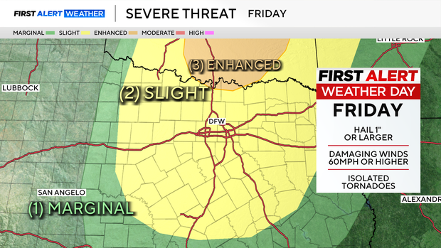
There will be a break in the action Thursday for North Texas. Highs will still climb into the 80’s before storms return Friday afternoon, evening and night. There will be some severe storms with another risk of hail and tornadoes.
There’s also an increased risk of flooding by the second half of the weekend as rainfall totals when all is said and done may reach up to 4″ across DFW. Shower and thunderstorm chances remain in the forecast well into next week, with Tuesday, March 10, as the best chance.