Power outage safety tips
Here are some safety tips for dealing with power outages, from the U.S. Department of Homeland Security:
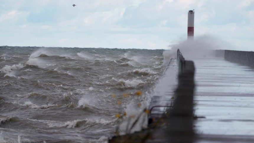
A powerful storm system expected to intensify into a “bomb cyclone” could bring strong winds, severe storms and travel disruptions across parts of the eastern United States early this week, with potential impacts for New York.
AccuWeather meteorologists said the rapidly strengthening storm will sweep across much of the country from the Rockies to the East Coast from Sunday through Monday. While blizzard conditions are expected in parts of the Upper Midwest, strong winds and severe thunderstorms could affect areas along the East Coast, including parts of the Northeast.
Widespread wind gusts of 40 to 60 mph are possible across much of the eastern U.S. as the system moves east. Forecasters say those winds could lead to downed tree limbs, power outages and hazardous travel in some areas.
The storm is also expected to cause significant travel disruptions nationwide, with possible flight delays or cancellations at major hubs including New York City, Boston, Philadelphia and Washington, D.C.
Severe thunderstorms may develop along the East Coast Monday, particularly from the Mid-Atlantic into the Carolinas. Some storms could produce damaging winds, heavy rain and isolated tornadoes.
In New York, residents may see gusty winds and periods of rain as the system moves through, with the potential for travel delays and scattered power outages, especially if strong winds develop.
Meteorologists say the storm could intensify rapidly enough to meet the criteria for a bomb cyclone, a term used when a storm’s pressure drops quickly over a short period of time, often leading to widespread and high-impact weather.
“This storm definitely means business,” John Feerick, AccuWeather senior meteorologist, said, adding the weather company has labeled it a “March megastorm.”
Wind advisory issued for upstate NY
A wind advisory has been issued for much of western and central New York, with strong gusts expected to develop Sunday evening and continue into Monday.
The National Weather Service said south winds of 25 to 35 mph with gusts up to 50 mph are possible starting at 5 p.m. Sunday. Winds are expected to shift to the southwest Monday, with occasional gusts still reaching 50 mph.
The advisory covers a wide area of western and central New York, including Niagara, Orleans, Monroe, Oswego, northern Erie, Genesee, Wyoming, Livingston, Cattaraugus and Allegany counties. It also includes Wayne, northern Cayuga and Ontario counties, as well as parts of the Finger Lakes and central New York such as Yates, Seneca, southern Cayuga, Onondaga, Steuben, Schuyler, Tompkins, Madison and Cortland counties.
Cities affected include Rochester, Buffalo, Niagara Falls, Batavia, Oswego, Canandaigua, Ithaca, Syracuse and Corning.
When winds will be strongest
The advisory runs from 5 p.m. Sunday through 8 p.m. Monday for most areas, though some central New York counties are expected to see the advisory end earlier Monday morning.
Forecasters said the strongest wind gusts are likely Sunday night, especially near the northern slopes of the Bristol Hills and across parts of Wyoming and Livingston counties.
Possible impacts
Gusty winds could blow around unsecured objects, down tree limbs and cause isolated power outages. Drivers — especially those operating high-profile vehicles — should use extra caution. Residents are also encouraged to secure outdoor items ahead of the storm.
Contributing: USA Today Network