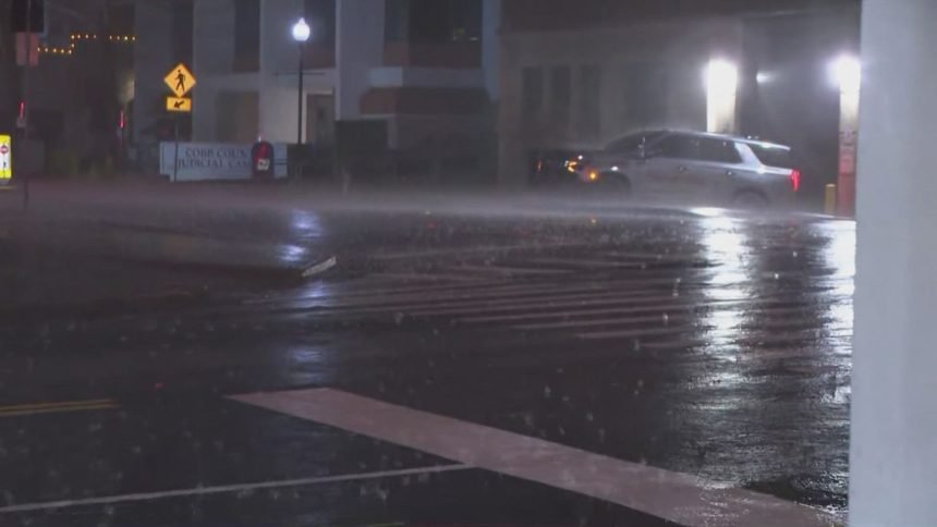
Severe storms swept across metro Atlanta and north Georgia Monday morning, trigger thunderstorm warnings and multiple Tornado Warnings.
ATLANTA — Severe storms are moving to the east and out of metro Atlanta on Monday morning just before 8 a.m., after moving across the region in the early AM hours and bringing thunderstorm and tornado warnings.
At least three Tornado Warnings were issued through the AM hours, impacting areas including Dalton, Lithonia and Thomaston
A ground stop at Hartsfield-Jackson Atlanta International Airport was put into place, extending through 9:30 a.m. There are more than 200 cancellations into and out of Atlanta this morning according to FlightAware data.
All of north Georgia was highlighted by the Storm Prediction Center’s level 2 and level 3 risk for severe weather.
A reminder that what follows this severe weather now is rapidly cooling air — with temperatures dipping down into the 30s by the afternoon and a Freeze Warning for the overnight hours into tomorrow.
Key weather points
- At 7 a.m., a Tornado Warning was issued impacting the Thomaston area through 7:30 a.m.
- At 6:11 a.m., a Tornado Warning was issued for DeKalb and Rockdale counties, including, Lithonia. It expired at 6:30 a.m.
- A ground stop is in place at Hartsfield-Jackson Atlanta International Airport through 9:30 a.m. at this point.
- At about 6 a.m., a Severe Thunderstorm including north Atlanta and the northeast metro was issued through 6:45 a.m. including all of DeKalb and most of Gwinnett. An earlier warning from 5:15-6 a.m. included all of Fulton and Cobb, and Hartsfield-Jackson Atlanta International Airport was included in both warnings.
- Shortly after 3 a.m., a series of Severe Thunderstorm Warnings began being issued in northwest Georgia as the system moved in from Alabama.
- A Tornado Warning was issued at 3:40 a.m. for Whitfield County, including Dalton. It expired just before 4 a.m.
- A Tornado Watch was issued for metro Atlanta and north Georgia counties. It updated a little before 7 a.m. to remove many counties. An earlier Tornado Watch also included several northwest Georgia counties through 6 a.m.
Updates
8:45 a.m. | We’ll transition this out of a live updates model now, though if anything big pops up we’ll continue to make updates here or there.
8:25 a.m. | Once again, still not quite over for our easternmost areas — Severe Thunderstorm Warning for Greene, Hancock, Putnam, Taliaferro, Warren and Wilkes counties until 9 a.m.
8:10 a.m. | Some Tornado Warnings down in central Georgia now, including one that impacted Macon.
7:58 a.m. | Latest Tornado Watch is going to remove the rest of our area and move this storm system down toward Augusta, Savannah and South Carolina.
7:48 a.m. | Things not quite over for our viewing area, with a Severe Thunderstorm Warning including Jasper, Jones, Monroe, Morgan, Greene and Putnam counties through 8:15 a.m.
7:40 a.m. | The airport ground stop has been extended through 8:30 a.m.
7:22 a.m. | This system is starting to push out east beyond our viewing area, though remember there will still be rain and lightning in some spots, then the cold starts to come in.
7:18 a.m. | Power outage update Almost 20,000 Georgia Power customers statewide without power, Georgia EMC listing 33,000+ outages across the state.
7:15 a.m. | Separate Severe Thunderstorm Warning impacting counties including Lamar, Pike, Upson until 7:45 a.m.
7:13 a.m. | New Severe Thunderstorm Warning for Butts, Jasper, Lamar, Monroe, Morgan, Newton, Putnam counties until 7:45 a.m.
7:01 a.m. | Tornado Warning in Lamar, Pike, Talbot and Upson counties:
6:54 a.m. | While we’ve been occupied with alerts here close to home, it’s also worth noting this same system produced multiple Tornado Warnings in south Georgia, including in Douglas.
6:52 a.m. | There’s a more isolated Severe Thunderstorm Warning around Homer through the next roughly 10 minutes.
6:50 a.m. | Update to the Tornado Watch, Atlanta and the northwest metro/north Georgia now out of it:
6:41 a.m. | The ground stop at Hartsfield-Jackson is extending through 7:30 a.m.
6:40 a.m. | Another Severe Thunderstorm Warning impacting farther south but including Meriwether, Lamar, Pike and Upson counties through 7:15 a.m.
6:35 a.m. | Severe Thunderstorm Warning including Butts, Fayette, Henry, Lamar, Meriwether, Newton, Pike, Spalding until 7:15 a.m.:
6:30 a.m. | New Severe Thunderstorm Warning for Banks, Barrow, Clarke, Gwinnett, Hall. Jackson, Madison, Morgan, Newton, Oconee, Rockdale, Walton counties until 7:15 a.m.
6:14 a.m. | A Tornado Warning has been issued for DeKalb and Rockdale counties including Lithonia:
6:05 a.m. | New Severe Thunderstorm Warning for north Georgia including Cleveland, Young Harris and Hiawassee until 6:15 a.m.
6:02 a.m. | Another Severe Thunderstorm Warning including the airport and the northeast metro through 6:45 a.m.
5:59 a.m. | New Severe Thunderstorm Warning covering a huge area for Clayton, Coweta, Fayette, Harris, Heard, Henry, Meriwether, Muscogee, Pike, Spalding, Troup counties through 6:30 a.m..
5:52 a.m. | Storm system will be moving toward the heart of Atlanta about now.
5:23 a.m. | Another Severe Thunderstorm Warning for west Georgia, including Carroll, Coweta, Fayette, Heard, Meriwether and Troup until 6 a.m.
5:22 a.m. | At the same time as the Severe Thunderstorm Warning for Atlanta, we got one for north Georgia including Canton, Dahlonega, Jasper through 6 a.m. as well.
5:20 a.m. | Wide-scale Severe Thunderstorm Warning now for City of Atlanta, including airport and south Fulton, north Fulton, Cobb, parts of DeKalb and more through 6 a.m.:
4:57 a.m. | Power outage situation beginning to develop, as Georgia Power lists more than 2,300 customers impacted, mainly in northwest Georgia where the storms have moved through already, and Georgia EMC has more than 3,000 outages in north Georgia.
4:55 a.m. | And another new Severe Thunderstorm Warning for Bartow, Cherokee, Dawson, Gordon, Pickens until 5:30 a.m. Cartersville and Canton included in this one:
4:50 a.m. | New Severe Thunderstorm Warning for Carroll, Haralson, Paulding, Polk counties until 5:15 a.m., including Carrollton, Villa Rica and Dallas. Another for Gilmer, Lumpkin, Pickens, Towns, Union and White until 5:15 as well that includes Dahlonega, Cleveland and Ellijay.
4:37 a.m. | New Severe Thunderstorm Warning for Haralson and Polk counties until 5 a.m.:
4:20 a.m. | Severe Thunderstorm Warning issued until 5 a.m. for Bartow, Floyd, Gordon, Pickens counties:
4:15 a.m. | As you can see above, the Tornado Watch has been expanded to a wide area including Atlanta and its surrounding counties, and that will continue for that area through 10 a.m. Meanwhile, we have a new Severe Thunderstorm Warning until 5 a.m. for Fannin, Gilmer, Murray, Whitfield counties:
3:58 a.m. | Appears the Tornado Warning has expired.
3:42 a.m. | Tornado Warning in Dalton area until 4 a.m.
3:39 a.m. | New Severe Thunderstorm Warning including Bartow, Catoosa, Chattooga, Floyd, Gordon, Murray, Walker, Whitfield counties until 4:15 a.m.
3:15 a.m. | A Severe Thunderstorm Warning is in effect for Catoosa, Chattooga, Dade and Walker counties until 3:45 a.m.
2:20 a.m. | A Severe Thunderstorm Warning has been issued for Chattooga County until 3 a.m.
1:08 a.m. | A Tornado Watch has been extended for several more north Georgia counties until 6 a.m. The counties include Pickens, Chattooga, Bartow, Gordon, Floyd, Gilmer and Fannin counties.
LIVE RADAR