



What to Know
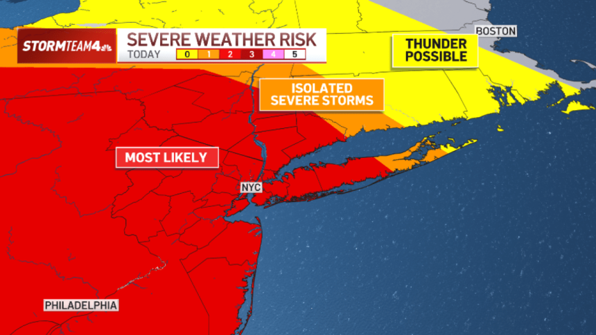
- The days leading into Labor Day weekend promise to be unsettled around the tri-state, with multiple rounds of strong-to-severe storms set to slice through the region through Thursday.
- Threats run the gamut, from damaging straight-line winds to isolated flash flooding, hail. and even a tornado or two. Areas west of the Hudson River are most at risk for severe weather.
- Each day, storms will develop over western NY and track southeast, moving through the Poconos, Catskills, and into northern NJ and the Hudson Valley before reaching NYC.
- Most areas will see manageable rainfall rates, but the strongest cells could produce 2 inches per hour or more. Isolated flash flooding is possible each day.
- Rain totals over these 3 days will be less than an inch for most of us. Only isolated locations will get more than that and face potential flooding.
Strong-to-severe storms are expected to batter the tri-state for days beginning Tuesday, with potential threats ranging from damaging wind and hail to flooding and isolated tornadoes.
Most areas will see manageable rainfall rates, but the strongest cells could produce 2 inches per hour or more, which can lead to flash flooding. Hail and damaging wind are the greatest concerns.
Track all the latest weather developments here.