What a day it was! Wednesday, Boston-Logan recorded a new record high temperature. The thermometer topped off at 98 degrees, breaking the previous record of 96 degrees set back in 1923. With dew points in the 70s, that meant the heat index reached 110 degrees.
Overnight into early Thursday morning, lows will only drop into the upper 60s and low 70s. Skies will be partly cloudy but we’ll be dry overnight.
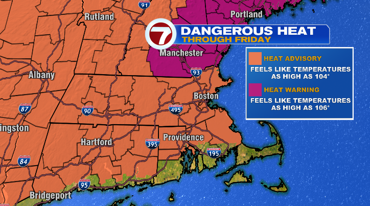
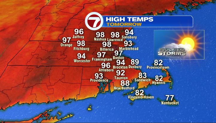
Tomorrow will be the last day of this heatwave. The Boston metro area is expected to skyrocket back into the 90s — specifically, 97 degrees. That’s close to the record of 98 degrees set in 1953.
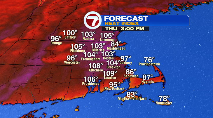
With dew points still hanging around the low 70s, that’ll feel like the low 100s. That’s downright dangerous for anyone who has to work outside.
We’ll be partly cloudy. The morning hours Thursday will be dry, but similar to Wednesday, in the late afternoon and evening hours we could see more isolated showers and thunderstorms.
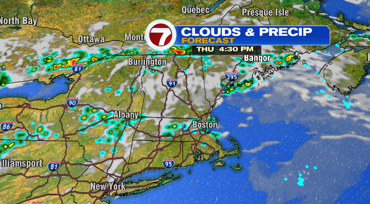
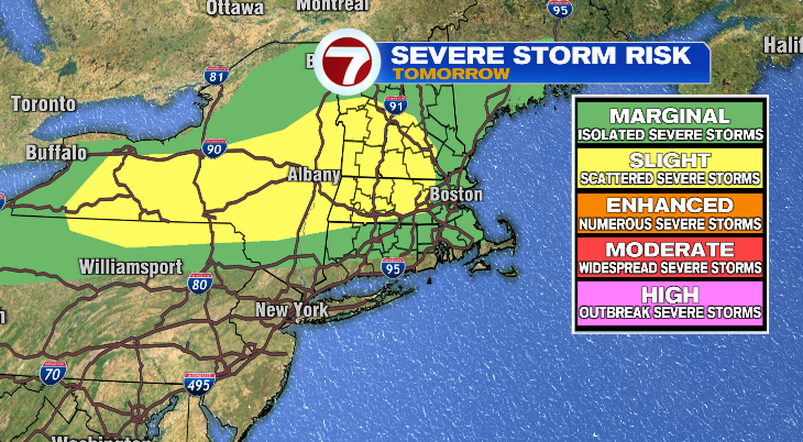
In fact, the heat, humidity and partial sunshine will create so much instability in the atmosphere that we have the risk for some strong to potentially severe thunderstorms.
Friday’s temperature forecast for the Celtics’ parade continues to drop. While the earlier morning will be warm in the 80s, a sea breeze will develop in the late morning and early afternoon allowing the temperature to drop to the 70s. It’s not all good news, though, as we still have some storm chances. We’ll be watching the timing of that closely throughout the day on Thursday.