A First Alert Weather Day has been declared for Monday due to cold, wind, and variable amounts of snow.

CBS
CBS
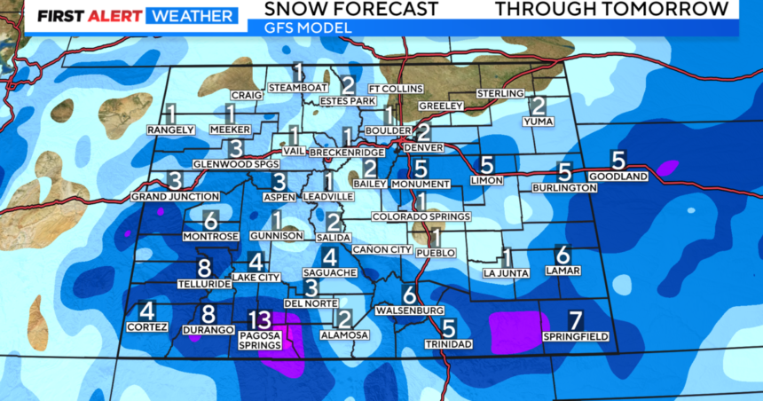
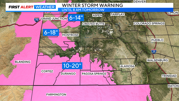
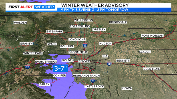
The center of the storm will stay in New Mexico and with it so far away from Denver, snow amounts will vary significantly along the urban corridor. The heaviest snow is likely to be found in the foothills south of I-70 including the Highway 285 corridor where a Winter Weather Advisory has been issued from 9 p.m. Sunday until 2 p.m. Monday. for 3-7 inches of snow.
CBS
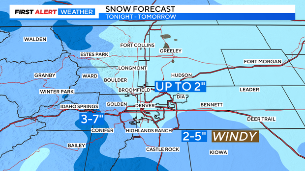
But while the heaviest snow will likely fall in places like Evergreen, Conifer, and Bailey, the worse conditions will likely be farther east along the Palmer Divide in Douglas and Elbert Counties and into the Limon area. This region will experience 2-5 inches of snow along with wind gusts to at least 50 mph which will cause considerable blowing and drifting. Areas from Castle Rock to Limon could experience blizzard conditions including total whiteouts.
For areas farther north including Denver, Aurora, Lakewood, and Boulder, total snowfall should be much less (1-2 inches) and will be mostly over by 5 a.m. Monday. Northern Colorado including Fort Collins, Loveland, and Greeley may not get any accumulation considering how far those areas are from the storm.
CBS
Regardless of snowfall, Monday will be cold and bluster across all of Colorado. Sunny and somewhat warmer weather will arrive on Tuesday but it won’t last long. Unsettled weather including daily chances for flurries and light snow starts Wednesday and continues for at least a week.