Saddle up, San Antonio — the Texas Department of Transportation wants help steering its new areawide bicycle plan.
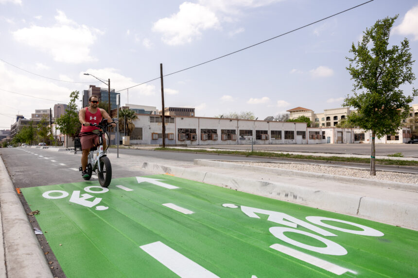
Through Aug. 9, TxDOT is seeking public input on its finalized draft of the San Antonio District Bicycle Plan, which aims to make San Antonio area bikeways safer.
From 2017 to 2021, 477 bicycle-involved crashes occurred on the state highway system within the San Antonio district, resulting in 12 fatalities and 50 serious injuries, leading to the effort, which launched in 2022. The new plan helps TxDOT and other agencies prioritize projects that will make San Antonio area roadways more friendly for cyclists.
Area residents can submit their comments on the new plan at TxDOT’s website here.
San Antonio was chosen by TxDOT as one of four initial metropolitan areas to receive a district bicycle plan and is the largest of the chosen areas which also include Bryan, Pharr and Laredo. The planning process will help develop an approach that can be applied in all 25 TxDOT districts, TxDOT stated on its website.
TxDOT’s new plan spans 12 counties, including Atascosa, Bandera, Bexar, Comal, Frio, Guadalupe, Kendall, Kerr, McMullen, Medina, Uvalde and Wilson. It analyzes the needs for bicycle infrastructure on the state highway system, prioritizes locations for bicycling improvements and identifies what role different routes should play in the bicycling network, TxDOT stated.
“Developing a regional framework is vital as the state works to provide safe, thoughtfully designed, well-maintained facilities for bicyclists within each district and between districts, providing connectivity across the state,” the draft plan notes in its introduction. “This is the next step for the state to plan more effectively for this mode of travel and develop an approach that can be applied across Texas.”
Stakeholder input
The planning process has taken a year and a half and has included gaining data and feedback from a technical working group, a community needs working group and consultants.
Members of the groups included staff from the city’s transportation department, the Alamo Area Metropolitan Planning Organization and VIA Metropolitan Transit.
“As the transportation policy-making organization for the multi-county region, we served as a liaison and provided critical, localized feedback to issues that affect Boerne, San Antonio, New Braunfels, Seguin, and everywhere in between,” AAMPO’s Multimodal Transportation Planner Matthew Moreno wrote in an emailed statement. “This plan outlines the needs for our entire region to develop a system of safe, viable, and attractive options for people of all ages and abilities to travel by bicycle.”
The city’s transportation department called the new plan “integral to the experience of cyclists within San Antonio,” since many of the state roads crisscross throughout the city. They noted the deadline is also approaching for comments on Phase 3 of the city’s Bike Network Plan, which will close on July 14. The city’s Bike Network Plan is anticipated to be completed in January 2025.
“Safe, comfortable lanes are necessary to help shape the connective bike network that San Antonio wants to use as an alternative to automobiles,” said Harley Hubbard, the city’s Bike Network Plan project manager.
VIA Metropolitan Transit often participates as a stakeholder in plans such as this one in order to “highlight the perspective of transit riders and the important connection with other modes of transportation, such as bicycles,” according to Josh Baugh, VIA’s director of communications.
For TxDOT’s plan, VIA focused on conveying existing bicycle and transit infrastructure, noting where there could be improvements to signage and bike parking, as well as providing insight to TxDOT into the services it provides and the facilities it has within the study area, Baugh said in an email.
“This information can help better identify where bicycle facilities and routes would best complement VIA’s services and facilities, and how to best determine how bicyclists can use transit facilities, in addition to bicycle facilities and routes to travel to farther destinations,” he said.
A look at the data
Several of the high-crash areas in San Antonio are located on existing or proposed bicycle tourism trail routes or other key segments that connect to municipalities outside of central San Antonio, TxDOT states. These streets are often multiple lanes, have higher speeds, and have no dedicated bicycle facilities.

The plan also rates which roads in the San Antonio District have high needs via one of three prioritization levels: high, proactive and opportunistic.
Overall, 87% of the state highway system in the San Antonio area exhibits at least one bicycling need, the plan states. For the San Antonio District, the high-priority segments generally occur in roadways that serve multiple trip types, including long-range commuting as well as hosting commercial and recreation destinations and are central within cities and towns.

high-priority segment is FM 78 roughly from Foster Road to Crestway Road. / Courtesy TxDOT.
TxDOT states that it will use gathered feedback to further finalize the draft plan and adds that “this plan is a first step that, while significant, only begins to address the need for bicycle improvements on the on-system highway network.”
The agency will work with local stakeholders as the plan evolves, TxDOT said.