Happy Monday, South Florida!
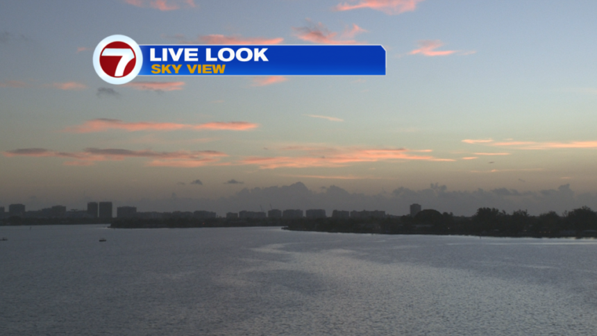
Hopefully everyone had a great weekend. After a week of very hazy skies due to Saharan dust across the region and a daily dose of afternoon storms to end the week, South Florida finally saw an improvement this past weekend as Saharan dust finally moved out of the region and allowed for drier air to move in. This allowed sunshine to return to South Florida, along with those slightly bluer skies we like to see. While Saturday morning started off with a few downpours, rain chances were lower to end the weekend. This morning, we woke up to warm conditions across South Florida with a few showers and thunderstorms surrounding the FL Keys.
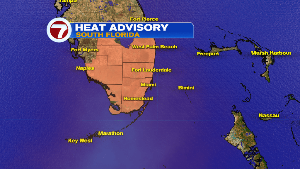
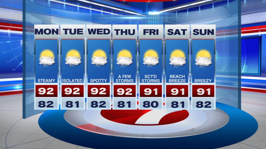
An area of high pressure in the Atlantic has built in across the region and similar to Sunday, should bring an overall nice day for us today. A tropical wave across the NW Caribbean could bring a few scattered showers & isolated storms for our southern locations but it looks like it might be mostly over water as the wave is moving west of the area. Our wind pattern will remain out of the east and times could be on the breezy side but temperatures will once again be a big story for South Florida. Will be reaching into the mid to lower 90s this afternoon while our feels like temperatures reach into the triple digits for extended periods of time. A heat advisory has been issued for all of South Florida, including the Florida Keys. So please remember to limit your time outdoors, if possible. And remember to take breaks from the heat from time to time.
Looking ahead, South Florida should remain relatively quiet through the middle of the week as drier air remains across the region. The work week does bring some slight changes to the forecast as an upper level disturbance could approach the area and increase our rain and storm chances for the latter part of the work week. The good news is that with a wind off the water, showers and storms will push through our East Coast metro through the morning and early afternoon hours before shifting focus to the Gulf Coast in the afternoons. High temperatures will reach into the lower 90s, but we’re hoping showers below criteria level during this time. A sneak peek for the weekend: South Florida will see a building East breeze once again, which will likely increase the rip current risk across area beaches.
Have a wonderful day. Remember to keep hydrated!
Erika Delgado
Meteorologist
WSVN / Channel 7 News
Copyright 2024 Sunbeam Television Corp. All rights reserved. This material may not be published, broadcast, rewritten or redistributed.