NEW YORK — New York and New Jersey coped with another day of excessive heat and humidity Wednesday, as well as severe weather.
Get the latest warnings, watches and alerts.
Storms cause damage across Tri-State Area
Wednesday was another active weather day as yet another round of severe thunderstorms plowed through the region. Even New York City got rocked this time.
These storms have produced numerous reports of downed trees, powerlines and even flash flooding.
The storm flooded a street in Newark, causing problems for drivers. At least eight cars got stuck and the occupants had to be rescued. Some of the cars were damaged and had to be towed.
In Rockland County, three people were injured by a lightning strike while having a picnic in High Tor State Park.
The weather also forced a Foo Fighters concert to be postponed at Citi Field.
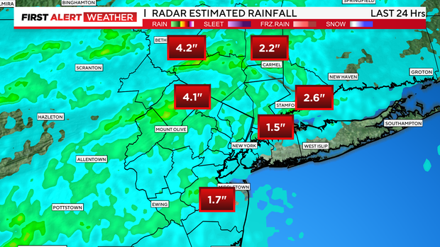
Rainfall totals ranged between 1 to over 4 inches, as they were able to wring all of the moisture out of the very humid airmass that has been in place for days.
CBS New York
When will the heat wave end in NYC?
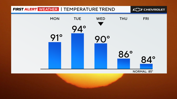
These storms will mark an end to our heat wave and usher in a much more comfortable airmass behind them.
CBS New York
Overnight, storm chances transition to just a few leftover showers. It will still be muggy though, with lows dropping into the 70s.
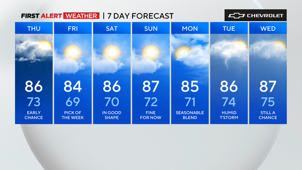
After a few morning showers, Thursday looks to be the nicest day we’ve seen in a while, with clearing skies, lowering humidity, and highs only reaching the low to mid 80s.
The return to normal temperatures is a welcome treat and should hold through the weekend.
CBS New York
Excessive heat explained
First Alert Weather maps
Stick with the First Alert Weather team for the latest forecast and weather alerts.


