The heavy lake effect snow has arrived in central New York as near white out conditions are being experienced in the heaviest snow bands.
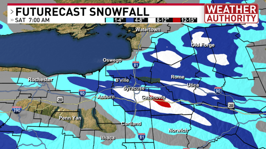
Here’s a look at the potential snowfall totals through Saturday morning. Notice a wide swath through Onondaga County could reach 8-12″ with isolated areas of Madison County getting over a foot.

Futurecast snowfall totals
The exact location of the heaviest snow is uncertain. But confidence is growing that the hardest hit areas will likely approach this 12″ total.

Futurecast snowfall zoomed in
With the combination of strong wind gusts today, driving conditions have rapidly deteriorated. If you absolutely have to be on the roads today, exercise extreme caution.

Temperatures will likely not escape the low 30s but with the strong winds it’ll feel significantly colder anyways.

High and low temperature forecast
The heaviest lake effect snow will wrap up around sunrise Saturday with another chance of rain/snow and strong winds returning on Sunday. Most of the snow accumulation Sunday should occur in the higher elevations of the Tug Hill.

BE THE FIRST TO COMMENT
For the latest forecast and live local radar click HERE.