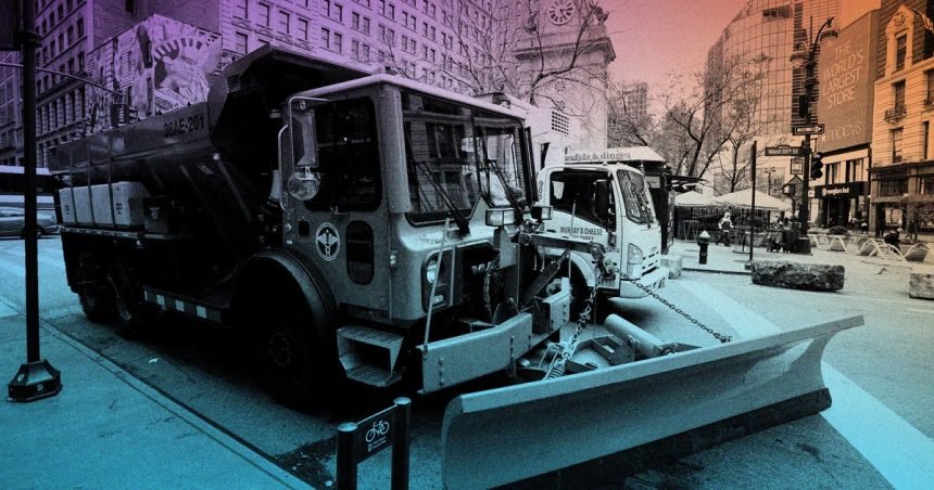
Photo-Illustration: Intelligencer; Photo: Getty Images
It’s been a long time since a major snowstorm set its sights on New York City, and residents are assuming once-familiar roles. Nervous weather watchers are overbuying at the grocery store, the mayor is projecting competence while crushing snow-day dreams, and John Homenuk — the enthusiastic but sober-minded meteorologist behind New York Metro Weather, whose “hype free” forecasts are a trusted resource for thousands of New Yorkers — is delivering cautious forecasts. On Friday, I spoke with Homenuk about what New York and the rest of the country can expect from an unusually expansive storm system and its frigid aftermath.
It’s fair to say that this storm is not going to be a miss at this point, right? There’s very little chance that we’ll get some paltry amount of snow?
Correct. The range I put out is six-to-ten inches for New York, followed by some sleet, and that’s very much on the conservative side. Which is definitely intentional, because I feel that the potential mixture mixing with sleet at some point during the storm creates a lot of uncertainty. It’s unclear to me when that sleet changeover is going to occur. So I’m at six to ten right now, but getting higher amounts than that is totally not out of the question.
That does seem to be the big question — at what point the sleet starts. But you think it will happen at some point, regardless?
I do. A little bit about the dynamics of this event: It’s definitely not a classic or one of the historic-looking snowstorms. Typically, our biggest storms come from systems that reform off the coast and form into a strong coastal low. If you remember January 2016 or even what’s called the Boxing Day Blizzard on December 26, 2010, those storms all had a coastal low that really strengthened rapidly off the coast of New Jersey and South Long Island. That’s how New York City tends to do the best with big snowstorms, because you have the dynamics from the strong coastal nor’easter, but when we are to the left of the low, the wind orientation brings in cold air from the north throughout the storm. So you are just funneling cold air in and you have the strong dynamics to keep the snow coming.
But this event is driven by a process called warm-air invection. Basically, it’s the movement of warm air from southwest to northeast. This storm is starting in Texas, and all that moisture and warm air is lifting up toward our area. It’s vectoring toward us, and that’s great for bringing a lot of moisture into the area, but it also brings warm air with it at multiple levels — not just at the surface but also a couple thousand feet above our heads. So we have a lot of moisture coming in from the south, a lot of lift to produce precipitation, but we also have this big Arctic high to the north. Typically, this would be a storm where it snows for a little and it flips over pretty quick. It wouldn’t be a big deal. It’s the massive Arctic high we have coming in just before the storm that’s making this so interesting and potentially significant. The combination of that big cold to the north and that moisture surging up from the south puts us right on this gradient where we could have quite a bit of snow before there’s any sort of changeover.
And that makes a changeover into sleet likely even if the actual air temperature is well below freezing?
Yeah, though I think that’ll happen after significant snowfalls. Sleet forms when you have a warm layer that is a couple thousand feet above our head, so the snowflake falls out of the cloud and it falls through that warm layer. The snowflake melts into a raindrop, essentially, and refreezes when it leaves that warm layer as it’s tumbling down toward us, since that warm layer is pretty thin. It remelts into an ice pellet, and that’s what hits the ground. So you can very much have sleet with temperatures in the single digits or teens at the surface. If it’s above 32 degrees at 3,000 feet, that snowflake is melting on its way down. So what’s going to be really close is — how far north can that warm layer get before the high pressure to our north pushes back on it? And New York City is right on the line.
On Friday, those trends show that the sleet line is near New York City or maybe just south of it, which is the nightmare scenario for my sanity. The takeaway for New Yorkers is this: There will be significant, and anything over six inches is considered significant by the National Weather Service. I think the floor on this is at least six inches. The ceiling will depend on whether we can hold off the sleet. If we can’t, I think it ends in this six-to-ten-inch range and then we flip over to sleet if we can. We probably have a decent chance of getting a foot of snow or maybe even a little more of that.
It’s also going to be freezing cold before and after the storm, and there’s no end in sight to that trend. So the effects might really stick around.
First of all, there’s a cold-weather advisory tonight in New York. That Arctic high is coming in, and I think it has slipped under the radar — that’s a weather joke.
Good one.
People have not really been talking about it. Wind chills will be down to as low as minus-10 degrees. So that should be kept in mind, because if I know New Yorkers, we’re going out tonight because we can’t go out tomorrow night and Sunday. And it is going to be really cold then behind the storm, with the snow pack and ice pack and Arctic air mass coming down — this is the real deal. This is really cold. And so we’re talking real-feel attempts below zero during the evening multiple days in a row.
And then, not to be the bearer of bad news, but there is probably another storm threat coming up. That one is a little more boom or bust; it could be huge or it could be nothing. It’s much more coastal-storm oriented, a little more like the classic ones of the past, but right now you’ve got some models showing nothing and some models showing a huge storm. The other thing I know about New Yorkers is we’re always trying to be prepared. So big cold, don’t forget about that — and then just keep an eye on next weekend. I’m going to leave that alone until this storm passes to avoid confusion.
This is affecting an enormous swath of the country, including places like Texas and Tennessee that don’t usually get a lot of snow and ice. What is causing such an unusual setup?
The Arctic cold — the press of cold I talk a lot about, these features called high-latitude blocks, and they are exactly what they sound like: a blocking high in the higher latitude, so Canada, Greenland, Alaska, We have a lot of them right now. There is a very strong high-latitude block over Alaska, and it stretches all the way across the Arctic and Greenland. That’s important because that blocking high takes all that air that typically is all the way up there and it dislodges it somewhere else. So in this case, it’s dislodging it straight down through Canada and into the United States. So you have this anomalously strong high pressure taking cold air and funneling it straight down into Texas, into the southeastern U.S., and you have a disturbance coming up out of Baja California at the same time. So it really is a timing thing where you have the incredible cold and the strong disturbance trying to drag moisture up. And the combination of that is leading to this really huge elongated area of winter weather across the country.
Which leads me to a point I definitely wanted to make sure people get about travel. I’ve gotten so many questions about this, and I think the travel impacts are going to be massive with this one. Someone said, “Why worry about travel on Saturday night if the storm’s not here until Sunday?” And I said, “Think about where your airplane comes from.” If your plane is connecting through Dallas or Atlanta on the way here, and there is a winter storm going on there, it’s not getting here. That’s how the cascade starts. So to me, if you’re flying from the second half of Saturday through all of Sunday and the first half of Monday, be prepared to have some problems. Maybe you get lucky and don’t have any, but this system is affecting seven major hubs for carriers, and it starts in Dallas and Atlanta late on Saturday into Sunday morning.
What does the pattern look like after that? Just more cold for a while?
For now, it looks cold and potentially stormy for the near future. I think at some point in February we’ll get a break, but even that month looks colder than normal. If I take a 30-degree forecast and drag it out for the next 30, 32 days, we’re at least ten degrees below normal for that timeframe.
But how reliable are these kinds of forecasts more than about ten days out? Isn’t making long-term projections like that a tricky business?
I would say specifics are not as accurate, but generalities are, and there’s multiple models showing temperatures below normal. So I think it’s more believable than not. With a long-range forecast, I wouldn’t look at a forecast that’s calling for 31.3 degrees on February 21, because there’s just no way to be that accurate. But predictability in the long-range forecast has increased enough so that if there are strong signals for below-normal temperatures on multiple pieces of guidance, it’s correct more often than not.
Are you excited after all these years of not much happening on the snow front around here?
I’m so excited. I love this stuff, man. First of all, it’s so cool to see how excited people are about it. New Yorkers want to learn, and they want to talk about stuff. So the last couple of days have been really fun, and I think there’s a real opportunity to communicate this storm effectively to people. So I’m having a great time. I grew up on the South Shore of Brooklyn, and I remember the ’96 blizzard, the President’s Day 2003 storm — those are some of my best memories as a kid. So yeah, I love snow. I get excited for this stuff.
This interview has been edited for length and clarity.


