Much cooler weather is on the way to the Valley after an extremely hot start to fall. Tuesday was the first day in three straight weeks when Phoenix’s high temperature did not break or tie a daily heat record.
National Weather Service meteorologist Glenn Lader said a storm system is headed toward Arizona, bringing a chance of rain and an end to the record heat.
“As we move through the week, we’re looking at a gradual cool down,” Lader said. “That’s going to drop temperatures considerably, so by Friday and Saturday we may be struggling to even hit 80 degrees.”
Lader said Phoenix may now have seen its last 100-degree day of the year. If so, Phoenix will close out 2024 having had 142 days in the triple-digits – that’s 31 more days of 100-degree heat than what’s typical in a year.
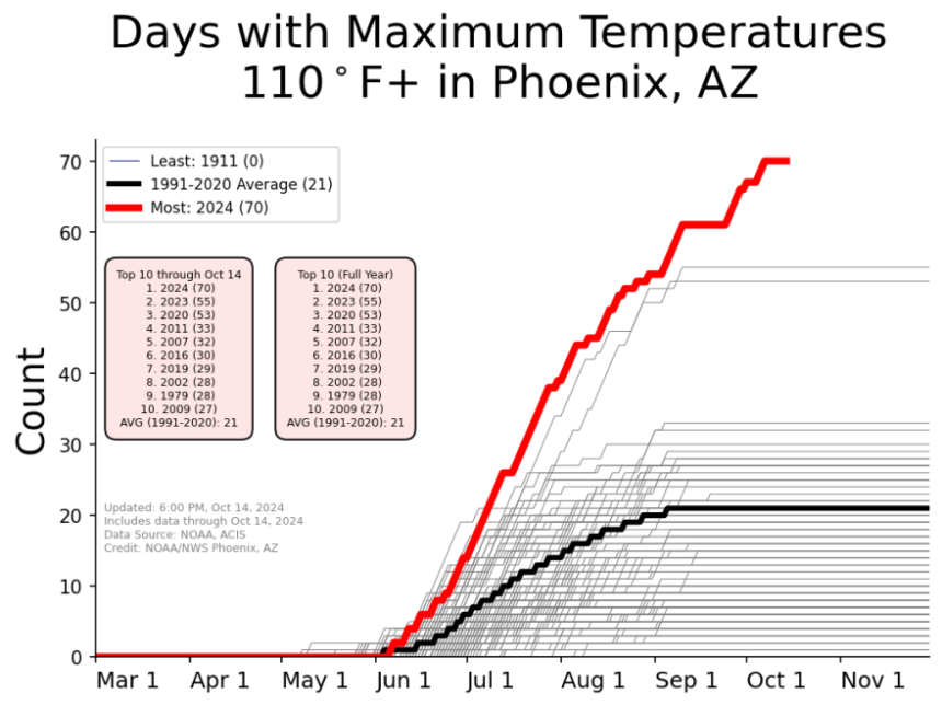
Phoenix has also had a record-shattering 70 days above 110 degrees this year. On average, just 21 days a year should get that hot.
And extreme temperatures in Phoenix this year lasted later than ever. Before this fall, the latest date Phoenix had ever hit 110 degrees was Sept. 19, back in 2010. This month’s unprecedented heat wave stretched that record until Oct. 7.
While triple-digit heat may be done for the year, Phoenix may still see more warmer-than-usual weather in coming months. The National Weather Service’s seasonal outlook shows about a 50% probability of above-normal temperatures for most of Arizona for November, December and January.


