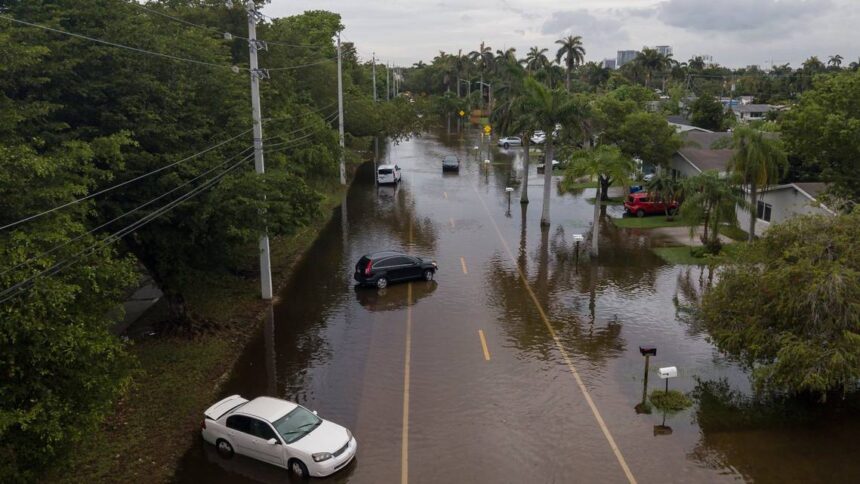
More rain is in the forecast for South Florida, which was left waterlogged with flooded roads, homes and stalled cars from a disturbance-fueled downpour this week.
A flood watch remains in effect at least through 8 p.m. Friday, with “heavy rain, scattered thunderstorms and “significant and life-threatening flash flooding” possible, especially across areas that experienced flooding earlier this week, according to the National Weather Service in Miami.
A flood advisory is also in effect until at least 4 p.m. Friday for parts of Miami-Dade and Broward, including Miami, Hialeah, Fort Lauderdale, Pembroke Pines, Hollywood, Miramar, Davie, Miami Beach, Key Biscayne, Surfside, Miami Gardens, Hallandale Beach, Virginia Key, North Miami, Doral, North Miami Beach, Aventura, Dania Beach, Miami Lakes and Cooper City.
MORE: What do all these flood alerts mean? What your phone is trying to tell you
Will South Florida see more flooding?
Forecasters don’t expect South Florida will see as much rain as earlier in the week, but some parts of the region are still inundated. And it won’t take much more rain to worsen the flooding and increase the risk of flash floods in hard-hit areas, according to Sammy Hadi, a meteorologist at the National Weather Service in Miami.
The forecast is calling for a 60% chance of rain Friday for Miami-Dade and Broward counties.
Hadi said this much rain isn’t typically a problem for South Florida, but the “threat is compounded” by the heavy rain that has doused the region since Tuesday. The brunt of the flooding rain was felt in Northeast Miami-Dade and South Broward.
“A few scattered showers are being picked up on radar across South Florida” Friday morning. “There is still standing water in several neighborhoods in southeastern Broward/northeastern Miami-Dade counties. Please exercise caution if you encounter any residual flooding,” the weather service said on X.
South Florida has seen 8 to 14 inches of rain since Tuesday, with North Miami and Hallandale Beach recording up to 20 inches of rain and Miami Shores recording 21.66 inches, according to the weather service. Miami Beach saw more than a foot of rain.
The most rainfall recorded in southern Florida during this week’s deluge — nearly 28 inches of rain — was at Big Cypress National Preserve Headquarters in Collier County, according to the weather service.
READ MORE: How much rain has dropped on your South Florida city? More than a foot? Check the list
“Additional amounts of 2 to 4 inches of rainfall are forecast through Friday with locally higher amounts possible,” according to the weather service’s flood watch. “These additional rainfall amounts will be capable of producing additional flooding on top of the ongoing flooding across portions of South Florida.”

What about the weekend forecast?
There is some good news: The disturbance that helped fuel the heavy rain has left Florida behind and is in the Atlantic ocean, just off the U.S. southeastern coast.
It left a “trail of moisture” behind but Friday is the “last day the plume” of tropical moisture will be over South Florida, said Hadi, the weather service meteorologist. The forecast is still calling for rain this weekend, but starting Sunday, it should start to be more in line with the region’s typical summer rain, according to Hadi.
Saturday’s forecast is calling for an 80% chance of rain in Miami-Dade and a 40% to 60% chance of rain in Broward. The forecast also has a 60% chance of rain in Miami-Dade and Broward Sunday and Monday.
“Scattered to numerous showers and thunderstorms will be possible through the upcoming weekend and into next week,” according to the weather service’s hazardous weather outlook. “The strongest thunderstorms could contain gusty winds and heavy downpours. Any heavy downpours could create the potential for additional flooding concerns especially during the upcoming weekend.”
This story was originally published June 14, 2024, 10:37 AM.


