It’s official: Monday is the hottest day of the year so far in New York City, according to the National Weather Service. Central Park hit 95 degrees at 1:43 p.m. as a heat wave continues in the city.
As you try to stay cool, here are heat stroke symptoms to watch out for in people and pets, and here’s a look at some of the best pools and beaches around our area.
Heat wave continues
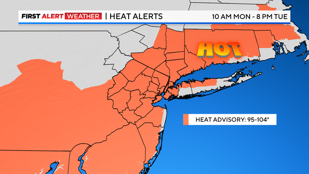
A Heat Advisory is in effect for most of the New York City area from noon on Monday until 8 p.m. Tuesday. Temperatures will feel like 95-104 degrees.
This is the area’s second heat wave of 2024.
CBS New York
Monday forecast
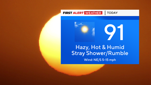
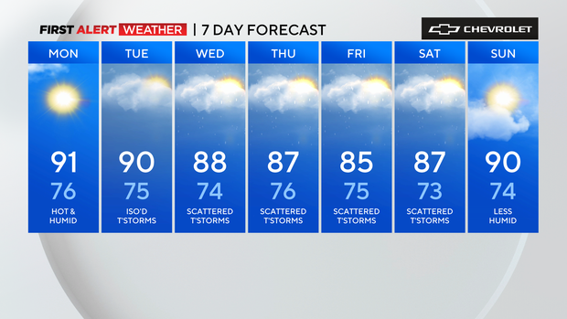
Monday will se a warm, sticky morning followed by hot and very humid conditions in the afternoon. A stray shower or rumble of thunder is possible. Highs will be in the low 90s, but it will feel more like 95.
Tonight, a stray shower or rumble is possible. It will be warm and very humid with lows in the 70s and 60s.
CBS New York
Tuesday weather
Tuesday will be hot and very humid with isolated thunderstorms in the afternoon. Highs will be around 90, but it will feel like 95+.
Wednesday forecast
For Wednesdays, expect it to be hot and very humid again with scattered thunderstorms in the afternoon. Highs will be in the upper 80s, but feeling like 95.
CBS New York
Thursday weather
On Thursday, it will be very humid again with scattered thunderstorms and downpours. High temperatures will be in the mid to upper 80s, but feeling like the low 90s.
Friday forecast
Friday will be very humid with a continued chance of storms. Expect highs in the mid 80s.


