We’re in for an active weekend of weather in Boston, with a bit of rain, snow and accumulation. This won’t be a blockbuster by any stretch, but the plows will be out and some tough travel is likely later in the day on Sunday.
The first round of precipitation arrives Friday night into Saturday morning. It’s enough to coat the roads in many spots, mainly outside of I-495. Boston will see little if any snow, though some brief rain showers are possible and a quick drop in temperature Saturday evening means any untreated surfaces could be a bit slick.
Sunday: Storm tracks to our east
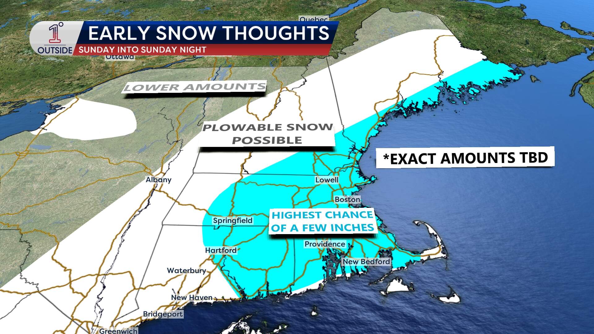
Sunday brings a more widespread, potentially plowable snow event but timing and location are everything. We’ll start Sunday on the quiet side with mostly cloudy skies. By afternoon, precipitation spreads in, starting as rain across Cape Cod and the South Coast, but switching to snow as temperatures drop. For Boston and much of eastern Massachusetts, the steadiest snow should fall Sunday evening into the overnight hours.
This round will bring a fluffier snow across interior New England — where temps will be stuck in the 20s — and a stickier snow the farther south and east you go.
As for totals? Still a bit early to lock in, but southern and eastern New England (including Boston) stand the best chance of seeing a few inches, enough certainly to bring out the plows. Some localized banding could enhance totals where snowfall rates pick up, particularly in the southeast, depending on how close the storm tracks.
Bottom Line: There are no big wind or coastal concerns. This should be a fairly fast moving event with a moderate impact.
What about the Patriots game?
If you’re heading to Gillette Stadium for the Patriots-Texans game Sunday at 3 p.m., temperatures will be in the mid-30s at kickoff, dropping into the lower 30s by game’s end. Snow should start moving in during the game, so you’ll want to plan accordingly for the ride home. The wind won’t be factor for the players or fans, so no added wind chill is anticipated.
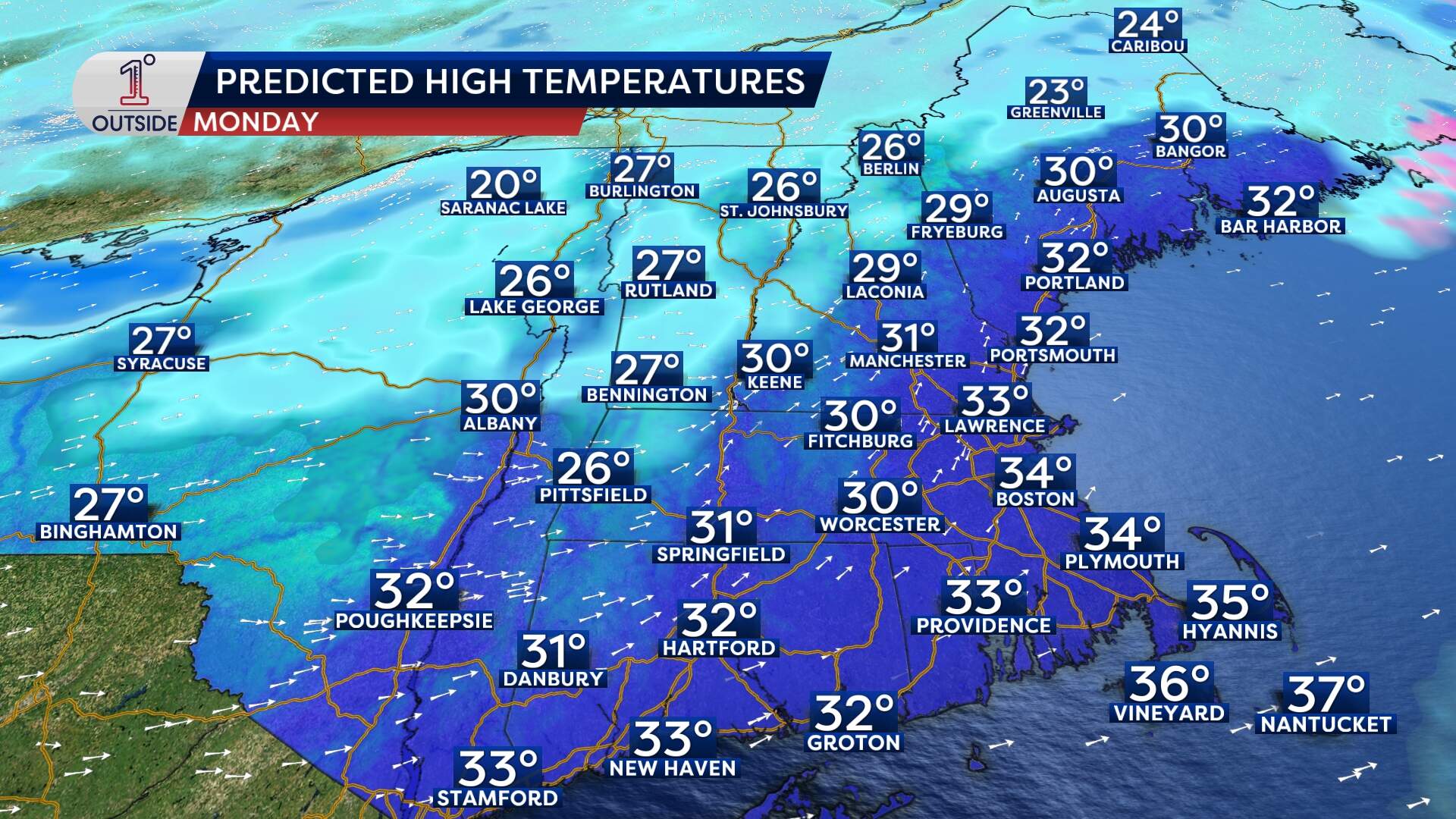
Arctic air arrives next week
After the weekend system moves out, get ready for another blast of arctic air. Monday will be below average, with highs in the low 30s before a true shot of cold air takes over by Monday night. Temperatures will drop into the teens overnight, and highs Tuesday will struggle to get out of the low 20s in Boston. The wind chills will make it feel even colder — single digits at best. Farther north, sub-zero wind chills and actual low temperatures below zero will make for a brutally cold start to midweek.