After several days of searing, summer heat, we’ve finally got some good news for the Tri-State Area.
We managed to squeeze out one last 90-degree day Wednesday, making it an unofficial 4-day heat wave. This brings our “90 degrees or better” tally to 15 days thus far this year.

CBS New York
On average, Central Park typically observes that many in an entire season – and there’s so much more to go!
Thankfully, a cold front pushed through earlier this morning, allowing a slightly cooler, less humid air mass to begin working its way into our area. That cooler front helped contribute to strong storms Wednesday night, when three people had to be treated after a lightning strike.
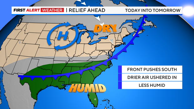
CBS New York
This will send our dew points – or the humidity – back into the 50s by Friday, which will make it feel much more comfortable out there. This will also keep our temperatures in check over the next couple of days, so we won’t be dealing with the 90s, just the 80s.
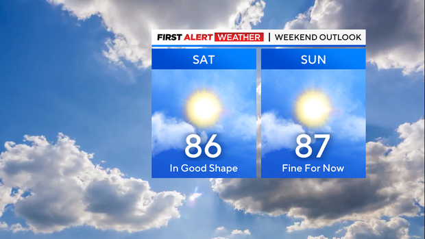
It looks like Friday’s the pick of the week with plenty of sunshine, seasonable temperatures and low humidity.
CBS New York
As for this weekend, we’ll reintroduce some clouds and a slight uptick in the humidity, but as it stands now, rain chances will only be around 10% both days.
Excessive heat explained
First Alert Weather maps
Stick with the First Alert Weather team for the latest forecast and weather alerts.