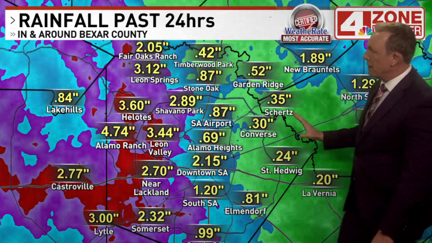
SAN ANTONIO – We were finally able to see a complex of storms rumble across our region earlier today where past complexes of storms have favored areas to our north and east. The best part of this complex and the heaviest rain from it, it fell over river recharge basins and the worst drought conditions in our region.
As an added bonus, we had scattered storms Sunday evening to early Sunday night in the area too. Between both rounds of storms, some areas saw in excess of 3 inches of rain.
CLICK HERE to track the rain with our interactive radar…
The atmosphere is pretty worked over from the early day activity for the rest of today. An isolated rain chance continues in our eastern zone counties that did not see as much rain early today and an isolated chance in the Hill Country should a storm up north move south into our area.
Otherwise, we’ll keep tabs on more storms up north overnight and see if they can move south into our area before falling apart. We’ll see a hit or miss shower or storm in the area Tuesday followed by more chances Tuesday night into Wednesday. After Wednesday, the pattern shuts down on these chances and we enter a period of hot, sunny days.
Additional rainfall in our region will range from .10″ to over 1″ locally if you see a heavier downpour from a storm.


