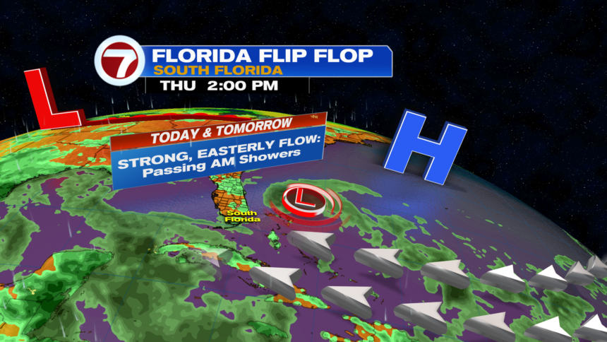
Similar as yesterday, our Thursday is off to an unsettled start with quick-moving, scattered showers pushing onshore across portions of South Florida. The good news is that despite the downpours, significant rainfall totals are not expected given their fast movement.
That onshore breeze should help focus afternoon activity inland, allowing for more sunshine and drier conditions. High temperatures will be in the upper 80s to low 90s.

It has already been feeling like summer and will continue to do so for the foreseeable future, however, with highs hovering in the upper 80s to low 90s over at least the next seven days!

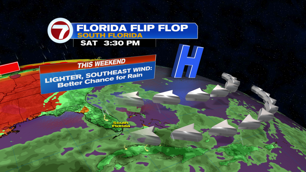
We’ll see some changes to our pattern beginning this weekend as a lighter, southeast wind flow dominates. With enough moisture in the area, expected scattered showers and storms near the coast in the morning, then that activity should become more confined inland during the afternoon.
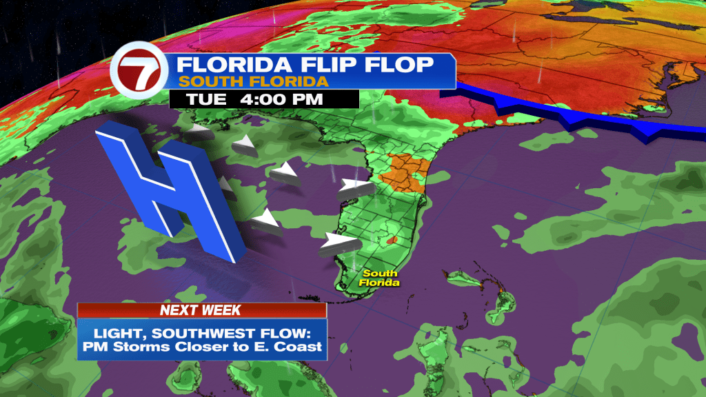
More changes are then forecast to arrive much of next week with a higher chance for seeing afternoon showers and storms as high pressure develops over the Gulf of Mexico, allowing for a lighter, southwest wind flow.
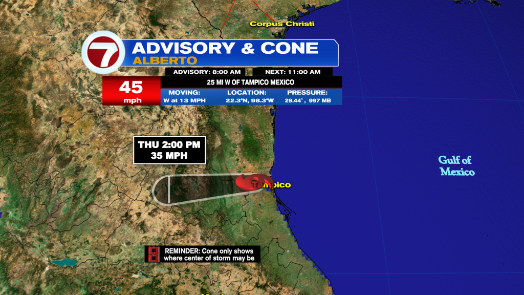
In the tropics, Tropical Storm Alberto has strengthened overnight over the southwestern Gulf of Mexico but has made landfall on Mexico as of 8AM this morning, bringing heavy rain and gusty winds to parts of the country in addition to southern Texas.
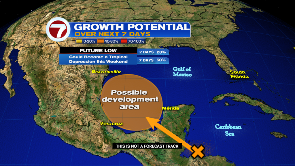
There are also two additional areas to watch for potential development: Invest 92L over the southwestern Atlantic Ocean and a future area of low pressure set to develop over the Bay of Campeche.
Invest 92L has a medium, 40% chance of developing and this small area of low pressure is forecast to track into the northern Florida coast on Friday, bringing minor impacts there.
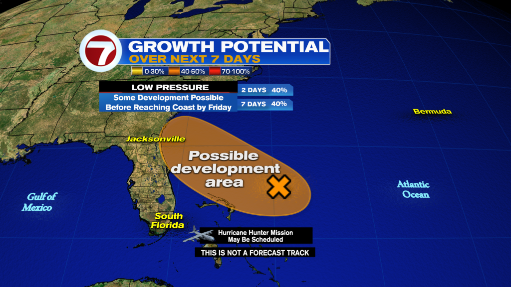
The future low near Central America has a higher chance of developing at 50% chance and could bring impacts to Mexico once again next week regardless of development.