A storm system is set to move across Massachusetts and the greater Boston area on Monday, bringing the threat for strong to locally severe thunderstorms with heavy rainfall.Some of the storms could bring localized flooding. Lightning, hail and damaging winds are also possible. Showers may include thunderstorms, with a possibility of severe weather, particularly west of Boston.”This line of storms that’s really starting to erupt with a good amount of lightning and even some small hail,” StormTeam 5 meteorologist Kelly Ann Cicalese said, referencing storms near the western border of Massachusetts. “While downpours at the greatest risk, there will likely be some damaging wind and small hail within these storms as well.”Storms were expected to move into central Massachusetts around 6 p.m. and into the greater Boston area around 7 p.m. or 8 p.m. Interactive Radar | Weather AlertsShowers are anticipated to continue into Tuesday morning, followed by clearing skies and a drop in humidity.”Some areas are going to get much more than others,” said StormTeam 5 Chief Meteorologist Cindy Fitzgibbon. “So you may see under a half an inch of rain, while other localized spots in downpours pick up over two inches.”The weather on Wednesday and Thursday is expected to feel more like September, with temperatures between 70 and 75 degrees and low humidity.
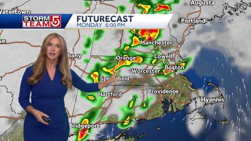
A storm system is set to move across Massachusetts and the greater Boston area on Monday, bringing the threat for strong to locally severe thunderstorms with heavy rainfall.
Some of the storms could bring localized flooding. Lightning, hail and damaging winds are also possible.
Showers may include thunderstorms, with a possibility of severe weather, particularly west of Boston.
“This line of storms that’s really starting to erupt with a good amount of lightning and even some small hail,” StormTeam 5 meteorologist Kelly Ann Cicalese said, referencing storms near the western border of Massachusetts. “While downpours at the greatest risk, there will likely be some damaging wind and small hail within these storms as well.”
Storms were expected to move into central Massachusetts around 6 p.m. and into the greater Boston area around 7 p.m. or 8 p.m.
Interactive Radar | Weather Alerts
Showers are anticipated to continue into Tuesday morning, followed by clearing skies and a drop in humidity.
“Some areas are going to get much more than others,” said StormTeam 5 Chief Meteorologist Cindy Fitzgibbon. “So you may see under a half an inch of rain, while other localized spots in downpours pick up over two inches.”
The weather on Wednesday and Thursday is expected to feel more like September, with temperatures between 70 and 75 degrees and low humidity.


