The storm, which was downgraded from hurricane status for now, will enter the Gulf of Mexico on Friday night as it nears the Texas coast.
SAN ANTONIO — All eyes will be on the Gulf of Mexico this weekend as Tropical Storm Beryl enters, bringing a flooding threat to Texas closer to the start of next week.
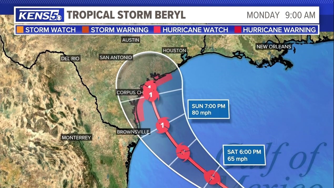
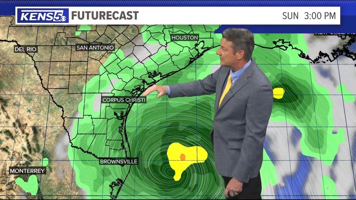
With each new advisory, Beryl’s landfall forecast is moving up the Texas coast. As of Friday night, landfall appears most likely between South Padre Island and Corpus Christi; it’s expected to arrive very early Monday morning. It’s also expected to strengthen back into hurricane status before that point before hitting the Texas coast as a possible Category 1 storm,
That means winds of near 80 to 85 mph with stronger gusts, significant storm surge along the coast and heavy tropical rains causing localized flooding. But as of now it appears that coastal communities like Port Aransas and Rockport could be to the west of the storm’s center.
Where is Beryl now?
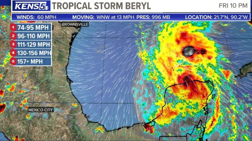
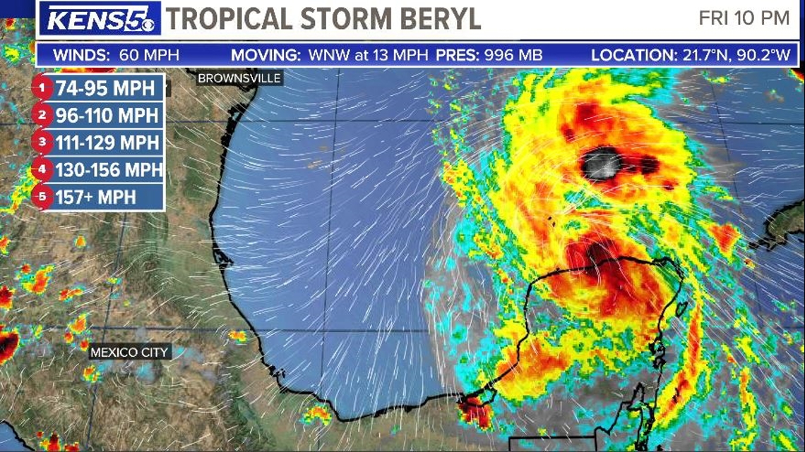
The storm’s center of circulation has entered open water in the southwestern Gulf of Mexico after making its way across Mexico’s Yucatan Peninsula on Friday afternoon. As of 10 p.m. Friday, Beryl was a tropical storm with maximum sustained winds of 60 mph and it was moving at speeds of 15 mph.
What is the window for landfall in Texas?
As of Friday night, Beryl is expected to make landfall sometime between 7 a.m. and 9 a.m. Monday as a Category 1 storm. It’s expected to make landfall with sustained winds of 80 mph.

How will Beryl impact San Antonio?
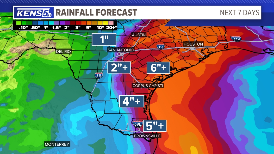
While the flooding threat for the Alamo City has decreased, things can still change over the weekend as the storm nears. The latest scenario is projecting lower rainfall totals for San Antonio; as of Friday afternoon, it’s appearing as though we might now receive just 1 to 2 inches in the city from the western side of Beryl.
The Texas Hill Country, parts of which remain in major drought, is currently projected to receive even less rain: Anywhere from half an inch to 1 inch. The chance for flooding grows the further east one goes from San Antonio; as of now, communities like Gonzales, Cuero and Cameron face a greater than 50% chance of seeing more than 2 inches of rain by next Wednesday evening.


How warm will it be the next few days?
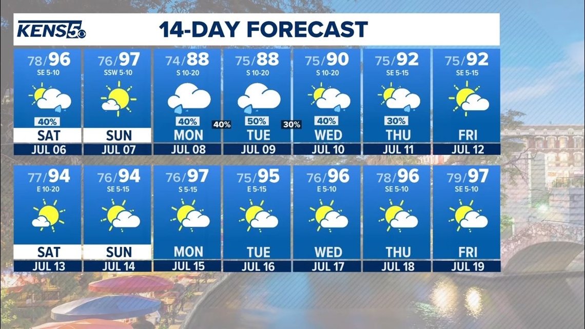
No matter how much rain San Antonio gets, Beryl’s arrival to Texas will bring down our high temperatures from the triple-digit conditions we saw as recently as July Fourth.
Here’s how the next several days are shaping up on the thermometer in the city:
- Saturday: High of 96, low of 78.
- Sunday: High of 97, low of 76
- Monday: High of 88, low of 74
- Tuesday: High of 88, low of 75
- Wednesday: High of 90, low of 75
- Thursday: High of 92, low of 75
- Friday: High of 92, low of 75

What determines hurricane strength?
- Category 1: 74 to 95 mph
- Category 2: 96 to 110 mph
- Category 3: 111 to 129 mph
- Category 4: 130 to 156 mph
- Category 5: 157-plus mph