Today is the big St. Patrick’s Day parade in South Boston. The weather is quite seasonable for March! Highs in the 40s, mostly cloudy skies and staying dry for the duration of the parade and post parade celebrations. Wind chills make it feel like the 30s all day long.
Tonight we see some wind picking up from the south as a warm front lifts northeast through New England. That leads us to an impactful day for Monday.
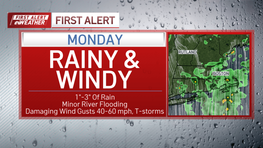
Monday is a First Alert day for impactful weather across New England. A powerful low pressure system moves across the country and will arrive in the northeast for Monday night.
Prior to Monday, the severe weather risk is quite high across the middle of the U. S. for Sunday night with numerous severe storms packing damaging wind, tornadoes, and hail.
Then the severe risk shifts across the Mid-Atlantic for Monday. A very low chance for a severe storm will be around New England for Monday night as some storms could go severe in terms of damaging wind gusts. Aside from the storms, the south winds will be strong anyway ahead of the cold front.
We pick up 1-2 inches of rain widespread through Tuesday morning. Listen for thunder and watch for lightning as pop up storm are also possible Monday afternoon as we see some lulls in the steady rainfall. The main cold front moves through around midnight Tuesday and the wind flips from the south, then from the west.

Tuesday for St. Patrick’s Day, the sky clears out and we stay breezy and cool with highs in the 40s. Wind from the west will be 20-40 mph, creating another chilly day.
Next week remains pretty quiet with a colder day on Wednesday (30s) to the 40s through next weekend.