



BURLINGTON, Vt. (WCAX) – While recent memory reminds us that October can bring crisp dry fall days, Tuesday deviated with widespread steady rain across northern New York and Vermont.
Rainfall was not just soggy — it was record-breaking in a few spots. And those totals only reflect what has fallen through 6 p.m.
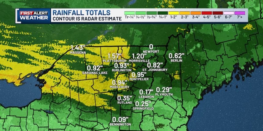
Rain was heaviest across the northern Champlain Valley and northern Adirondacks. Radar estimates show a broad swath of 1 to 2 inches from St. Lawrence County through Clinton County and into Franklin and Chittenden counties, with amounts dropping off quickly to the south. Bennington reported just 0.09 inches, while Burlington picked up 0.93 inches and Massena reached 1.43 inches.
The highest gauge reports so far today further highlight that northern focus. Fairfax led the way with 2.14 inches, followed by Westford with 1.94 inches and Saranac with 1.87 inches.
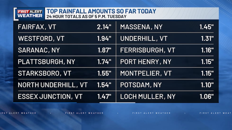
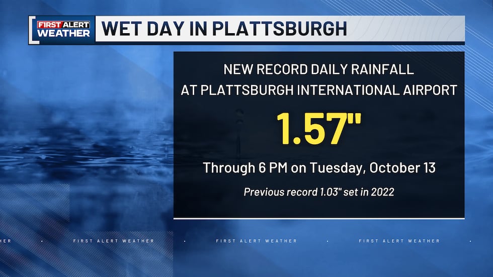
That steady rain was enough to set new daily rainfall records in two cities. Plattsburgh International Airport recorded 1.57 inches through 6 p.m., breaking the old Oct. 13 record of 1.03 inches set in 2022. In the graphic above, the 1.74″ came from a gauge just outside the city which means it does not count since it didn’t fall at the official climate site.
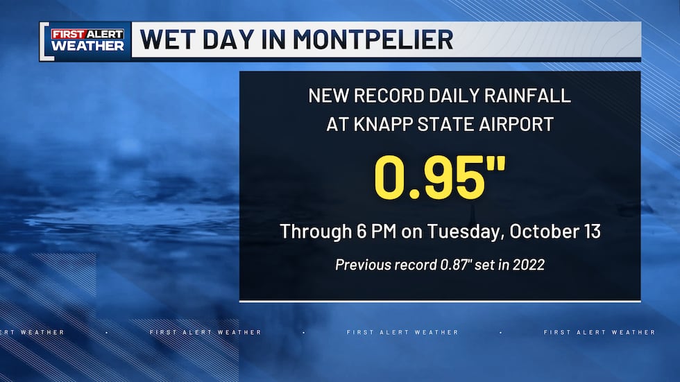
Knapp State Airport in Montpelier also set a new daily record with 0.95 inches through 6 p.m., topping the old Oct. 13 record of 0.87 inches set in 2022.
Other long-standing records held on. Burlington’s Oct. 13 record of 1.51 inches from 1927, Massena’s mark of 1.98 inches from 2005, and Saranac Lake’s mark of 1.10 inches from 1927 all remained intact.
Showers will taper this evening as drier air moves in from the south. You can track any lingering showers, changing foliage conditions, and the latest forecasts with the Channel 3 First Alert Weather team on-air and online. Stay connected with our free mobile weather app for hyper-local forecasts and live radar wherever you travel across the region.
Copyright 2026 WCAX. All rights reserved.