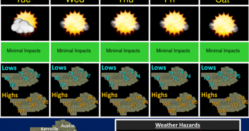
Temperatures will grow steadily warmer this week in San Antonio due to a subtropical ridge over the South Plains.
A low is also allowing warm and moist air to blow into San Antonio from the south and southeast, aggravating hot conditions.
The high on Monday was expected to top out around 95, but after increasing a degree each day, highs on Friday will be closer to 100. Even hotter temperatures will be felt in border cities to the west and southwest of San Antonio.
The weather pattern that dropped several inches of rain around San Antonio during the week has departed.
The aquifer has risen more than six feet since last week’s rains to more than 637 feet as of Monday. But it needs to rise to 650 feet and remain there for at least ten days for water restrictions to be lifted. Water enters the aquifer through the recharge zone outlined in white in the ten-day rainfall map above.
San Antonio’s annual rainfall of nearly 20 inches so far this year is now an inch above the year-to-date average.
Saharan dust returns to the San Antonio area on Wednesday and should keep air quality in the lower end of the moderate range for the city. The heaviest dust concentrations are expected over the Texas coastline and over the western Gulf of Mexico.


