Dig out your rain boots and ponchos! A nor’easter will wallop the Boston area with rain and gusty winds in a few days!
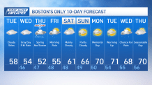
But first, as we continue moving through this Tuesday, expect mostly cloudy skies across Greater Boston. It will be cool with high temperatures in the upper 50s and lower 60s. Tuesday night, areas of drizzle are possible. Otherwise, we’ll see cloudy skies and lows in the mid 40s.
On Wednesday, we’ll see more clouds, along with a few scattered showers, especially by late afternoon and evening, all in advance of a nor’easter that will bring even more rain on Thursday. High temperatures on Wednesday will be in the mid 50s.

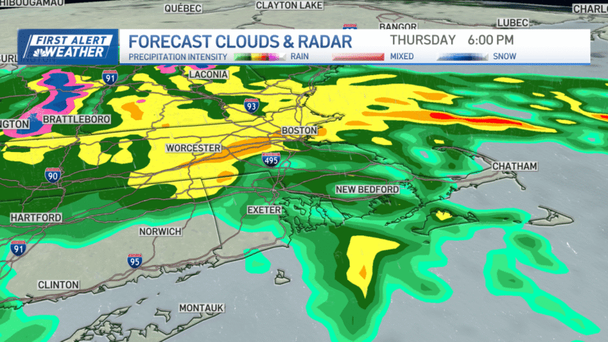
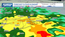
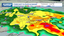
Heads up! Thursday is a First Alert as a spring nor’easter pushes rain and wind over our area. In fact, we’re tracking periods of heavy rain, capable of producing between 1 and 2 inches of rain in parts of southern New England. The rain will also be windswept.
New England nor’easter timing

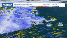
Storm could bring powerful wind gusts, coastal flooding
We’re expecting wind gusts up to 50 mph at times along the immediate coast on Thursday. We could also see some minor coastal flooding along the coast, with 1.5 to 2.5 foot storm surge in spots. We’ll watch it closely.
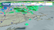
The storm system will churn to the north into Friday, still giving way to cloudy skies and a few showers, mainly into Friday morning.
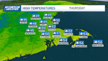
High temperatures on Thursday will be in the upper 40s and lower 50s. By Friday, temperatures will climb into the mid 50s.
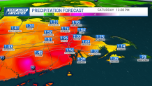
A few isolated showers are possible on Saturday, but by Sunday, our weather will begin to improve, with partly cloudy skies. High temperatures will be in the 60s Saturday and Sunday.
Then, by Memorial Day on Monday, we’ll see a mix of sun and clouds, with high temperatures near 70 degrees.