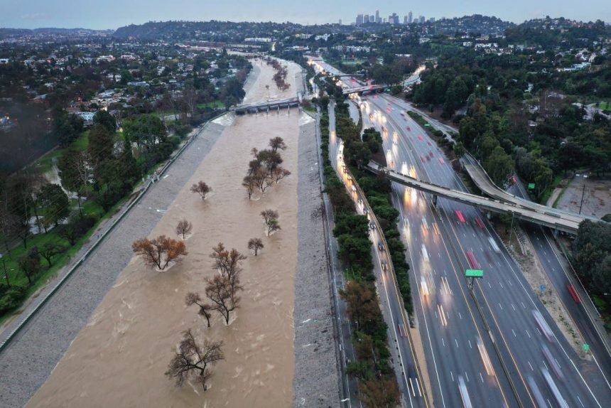
Los Angeles could receive an entire month’s worth of rain over a span of three days as a “significant” atmospheric river floods Southern California later this week.
The National Weather Service (NWS) warned that flash flooding could occur with the storm, and NWS Weather Prediction Center lead forecaster Bob Oravec told Newsweek the greatest impacts of flash flooding will occur if heavy rain falls over recent burn scars in the area.
Why It Matters
The storm is caused by an atmospheric river, which is a “long, narrow region in the atmosphere—like rivers in the sky—that transport most of the water vapor outside of the tropics,” according to the National Oceanic and Atmospheric Administration (NOAA).
The storms brought by atmospheric rivers are known for their heavy snow, heavy rain and strong winds. They are more commonly found on the West Coast, particularly during the winter months. Although the storms can bring beneficial snow that helps supplement reservoirs throughout the summer dry season, they can also trigger deadly flooding, mudslides and widespread power outages.
What to Know
Although atmospheric rivers are typical weather events in California during the winter months, November is a little early in the season for one to hit so far south, Oravec told Newsweek. The wettest months in California are usually December through February.
The incoming storm will bring widespread amounts of rain between 1 and 2 inches across much of California, with some higher-terrain regions expecting over 3 inches.
Los Angeles is expecting around 1.3 inches from the storm, according to a forecast from NWS Los Angeles, with the greatest chance of excessive rainfall occurring on Friday and Saturday. On average, the Los Angeles metropolitan area sees under 1.5 inches of rain throughout the entire month of November.
Oravec said receiving an entire month of precipitation from one event is “anomalous, but not unheard of.”
“Especially across an area that has a large standard deviation year to year with respect to precipitation,” he said. “The average doesn’t necessarily reflect what they typically get.”
The NWS issued a forecast on Wednesday about the impacts from the impending storm, warning that “scattered to isolated flash flooding will also be possible as far south as the Los Angeles metro area.”
What People Are Saying
Extreme weather chaser Colin McCarthy in a post on X: “Forecasted rainfall amounts have dramatically increased to 1.5–3 inches for Southern California this weekend, which would end fire season across the region. A significant atmospheric river will sweep across the state later this week, but it will slow down over SoCal as a cut-off low stalls offshore, bringing a potentially long duration of moderate to heavy precipitation.”
NWS Weather Prediction Center in a post on X: “A slow moving atmospheric river/upper low will bring threats of heavy rainfall to California. The threat will persist over a couple of days as the system may slow down across the region, particularly over portions of Southern California.”
What Happens Next
Rain and thunderstorms will begin in San Luis Obispo and Santa Barbara counties on Thursday, NWS Los Angeles said, with Los Angeles experiencing storm impacts by Friday, with a chance that they will linger into Saturday. The forecast could still change before the storm arrives,