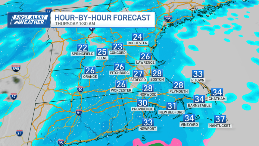
We’re ringing in 2026 across New England with cold temperatures and snow. A dusting around 1″ of snow is likely for the Boston Metro, with higher totals for central Massachusetts and the Cape.
By 10 p.m., Worcester County will start seeing the flakes fly, piling up to around 2″ in Central Massachusetts, with some spots nearing 4″. The Merrimack Valley and Greater Boston will start to see flakes flying just before midnight through early tomorrow morning. Boston and the Cape will see snow is just after midnight.

All and all — this won’t be a huge storm, but with many traveling and enjoying NYE festivities, it’s important to stay safe and diligent when planning transportation. Roads will get slippery by early morning.

Snow winds down as the sun comes up with one more burst possible with a cold front mid-morning. Then comes the wind and frigid temperatures.

Friday feels subzero for the morning, and single digits through the day. A bump in temperatures will come mid next week as highs get closer to normal by Tuesday. Normal highs for this time of year are in the upper 30s and we are climatologically nearing the coldest stretch in mid-January, where normal highs are in the mid 30s.