ATLANTA, Ga. (Atlanta News First) — A significant winter weather system will impact the Southeast this weekend, bringing the potential for rain, snow, and mixed precipitation to parts of Georgia. The First Alert Weather team is tracking two rounds of rain and wintry weather that could affect your weekend plans.
What to Expect Tonight and Saturday
Clouds will increase tonight as a cold front approaches from the northwest.
In the North Georgia mountains above 2,000 feet, there’s a chance of a rain and snow mix overnight into Saturday morning, with up to 0.5 inches of snow accumulation possible. While these amounts are small, they could create slick travel conditions in the mountains during the pre-dawn hours Saturday.
Metro Atlanta should see minimal rainfall — under 0.2 inches — with the rain staying light and scattered. The rain will end by 7AM Saturday with highs ranging from the upper 40s to low 50s.
The Main Concern: Saturday Night Into Sunday
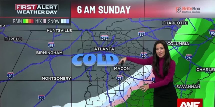
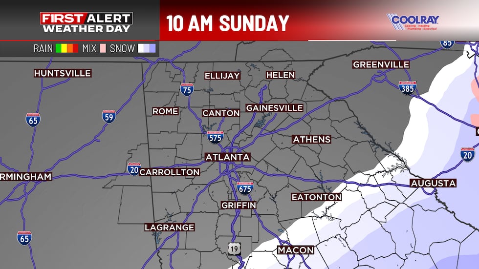
The bigger story unfolds Saturday night into Sunday, when a second system brings another round of moisture and cold air into Georgia. This is why Sunday is a First Alert Weather Day.
Here’s what we’re tracking: Rain in south and middle Georgia will encounter a cold air mass moving in from the north, possibly transitioning to a wintry mix or wet snow.
The greatest risk for accumulating winter precipitation is south and east of metro Atlanta — areas like Columbus, Griffin, and Madison are in the highest risk zone.
What About Metro Atlanta?
It is unlikely we will see wintery weather in metro Atlanta, and chances remain very low. Areas south of I-85 will need to continue to monitor the weather this weekend, for potential changes. Right now, the highest chance of any flurries will remain south of our viewing area.
Sunday: Breezy and Cold
Regardless of precipitation, Sunday will be noticeably colder and breezy across the region. Sustained winds around 10-20 mph will make it feel even colder, so bundle up if you’re heading outside.
Looking Ahead
Dry conditions return Monday through Wednesday, but don’t expect relief from the cold. Humidity levels will drop dramatically, creating critical fire weather conditions. Gusty winds could develop, potentially leading to Fire Danger Statements or Red Flag Warnings Tuesday and Wednesday.
A chance of rain returns by Thursday as moisture begins to return to the region.

Copyright 2026 WANF. All rights reserved.