As we head into mid-June, the Caribbean is waking up. Waters are abnormally warm, and there are two tropical disturbances the KPRC 2 Storm Tracker team is monitoring, one of which is of special interest in Texas.
The line of storms currently wreaking havoc on Florida has a 20% chance of becoming a tropical system as it moves northeast away from the United States into the western Atlantic basin.
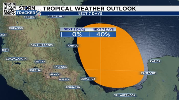
Regardless of formation, this system could bring heavy rainfall to the Houston area as early as Sunday afternoon. All models have development in the Bay of Campeche, with propagation staying in the far southwest portion of the Gulf.
Portions of Mexico could see a foot of rainfall. Right now, it is still uncertain how much we will see in southeast Texas, but coastal areas and places south of I-10 should see the highest totals.
There is a strong high-pressure system over the eastern United States that will bring high heat and should also block these tropical disturbances from seeing any path shifts north.
The development of these tropical disturbances is a good reminder that hurricane season is here. Check out the stories below to make sure you and your family are prepared.
Copyright 2024 by KPRC Click2Houston – All rights reserved.