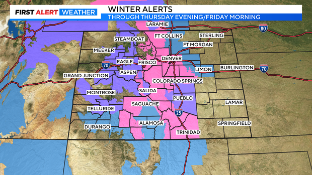
A storm system that was off the coast of the Pacific Northwest early Tuesday morning is headed for the Rocky Mountain region and is projected to bring wind and high snow totals to Denver starting late Wednesday. On Tuesday it was already bringing rain and snow inland.
CBS
The snow totals for some of the southern and western parts of the Denver metro area could be near a foot and a half. But the entirety of the metro area is expected to see big snow — 8″ or more — starting Wednesday night as rain, then changing over to snow and continuing with major snowfall through the day Thursday.
The storm system is projected to bring heavy, wet snow to Colorado’s Front Range in part because of upslope winds that will be coming from a separate low-pressure system forming to the northeast.
“We are definitely looking at some significant snow for Denver and west. As you head west of Interstate 25, the snow totals will only increase,” said First Alert Meteorologist Alex Lehnert. “We’re looking at the possibility of as much as 3 feet of snow into some of our Front Range mountains, into Summit County possibly as well.”
CBS
Colorado’s Eastern Plains and parts of Northern Colorado will not see as much accumulation with this storm.
There is still some uncertainty with this forecast as the storm track could change, impacting potential totals and timing.


