Denver Weather
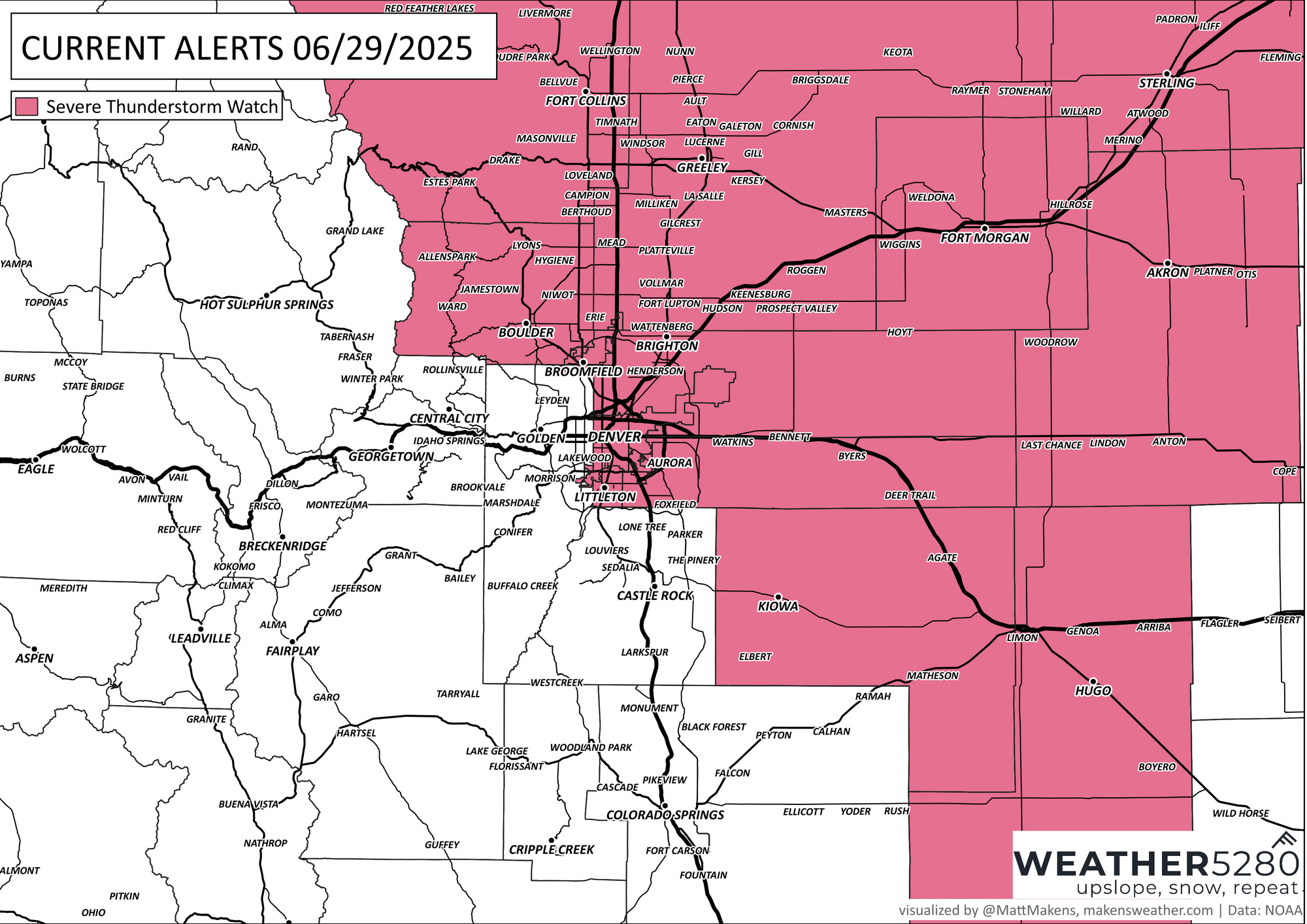
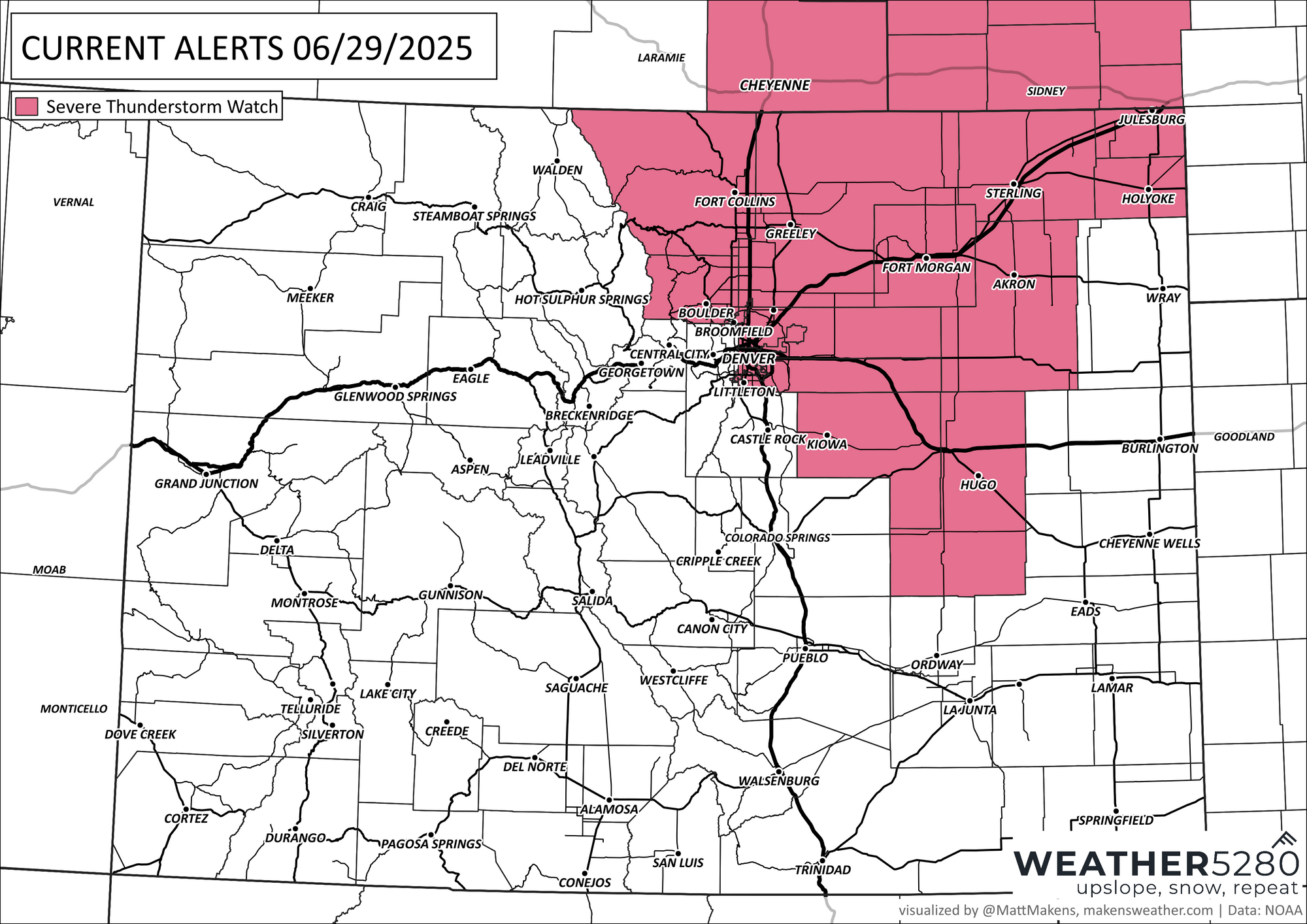
Watch issued: Severe Thunderstorms Possible This Afternoon in Denver and Northeast Colorado
In brief: A Severe Thunderstorm Watch is in effect until 9 PM for the Denver metro and northeast Colorado. Storms could bring hail and strong winds. Cooler weather and more rain are expected into early next week.
In detail: Severe thunderstorms are possible this afternoon and evening along the I-25 corridor and across the northeast plains, including the Denver metro area. A Severe Thunderstorm Watch is in effect until 9 PM. The main threats will be large hail and damaging wind gusts, especially from mid-afternoon through early evening.
Storms could begin developing as early as 2 to 3 PM, with activity increasing through the late afternoon commute. While not every area will see severe weather, any storms that do develop could become strong quickly. Some models suggest storms may struggle to move far east of I-25, but others show potential for strong storms moving into the far eastern plains later this evening.
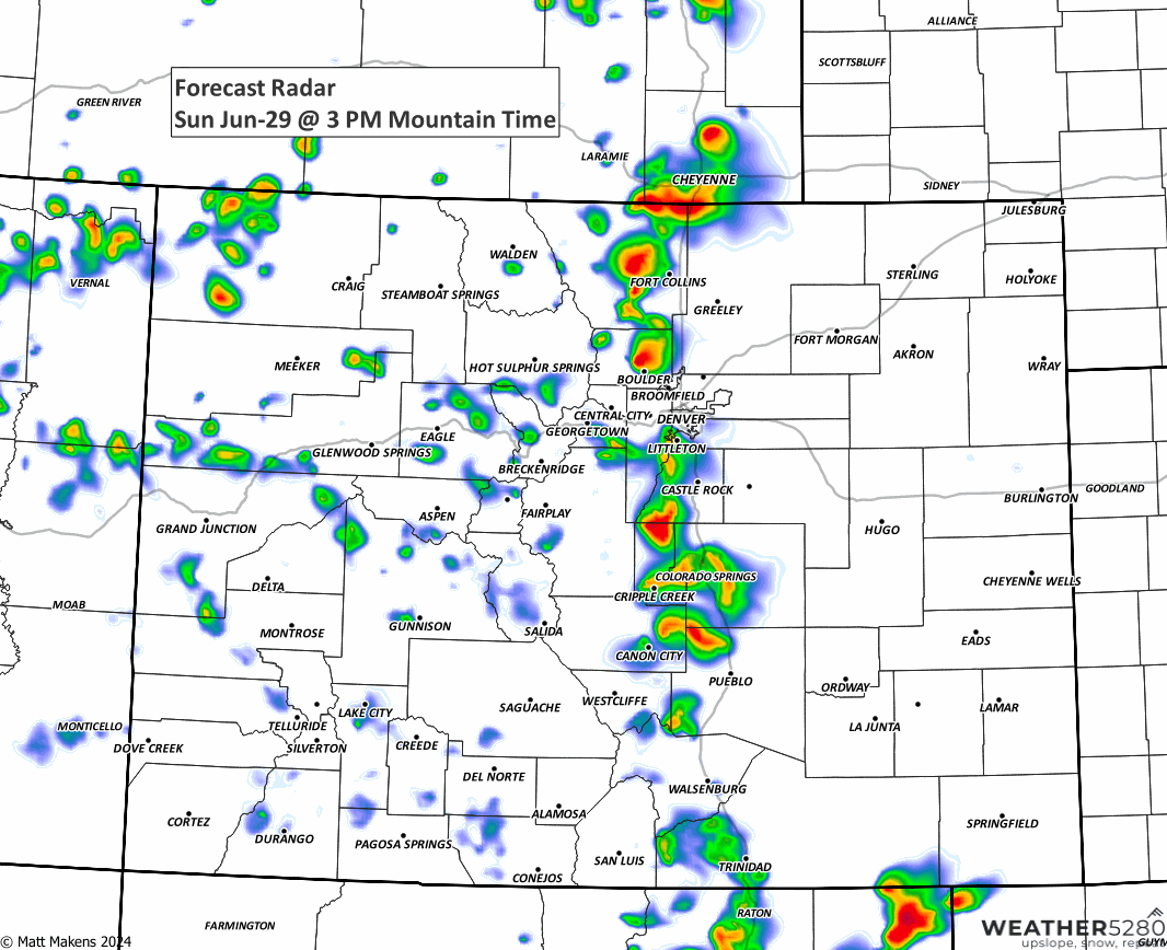
There is also a chance for some overnight thunderstorms, mainly between 2 and 6 AM, especially closer to the Wyoming and Nebraska borders. These storms would be more isolated but could still carry some strength if enough instability remains.
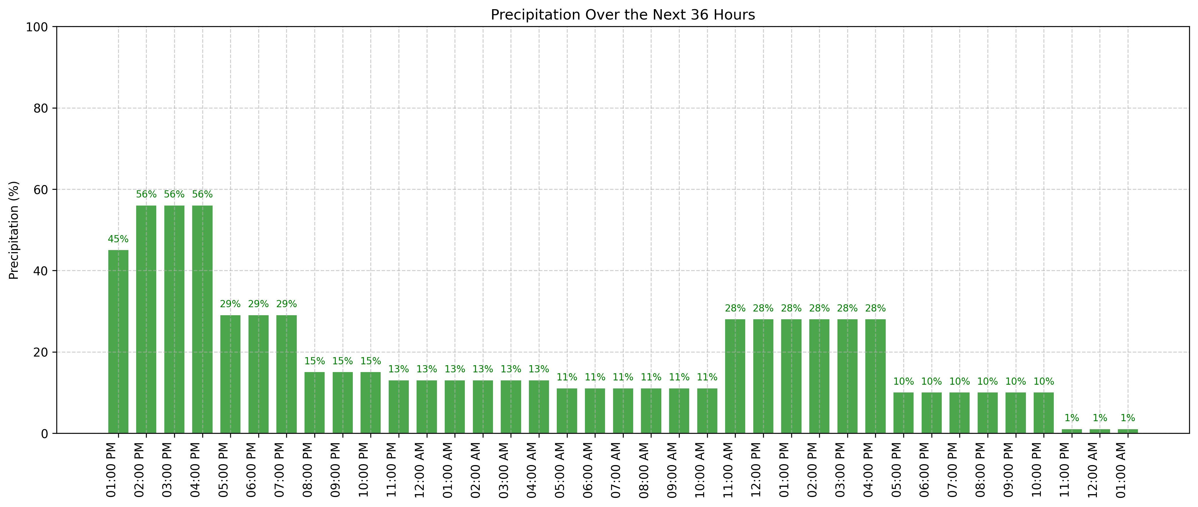
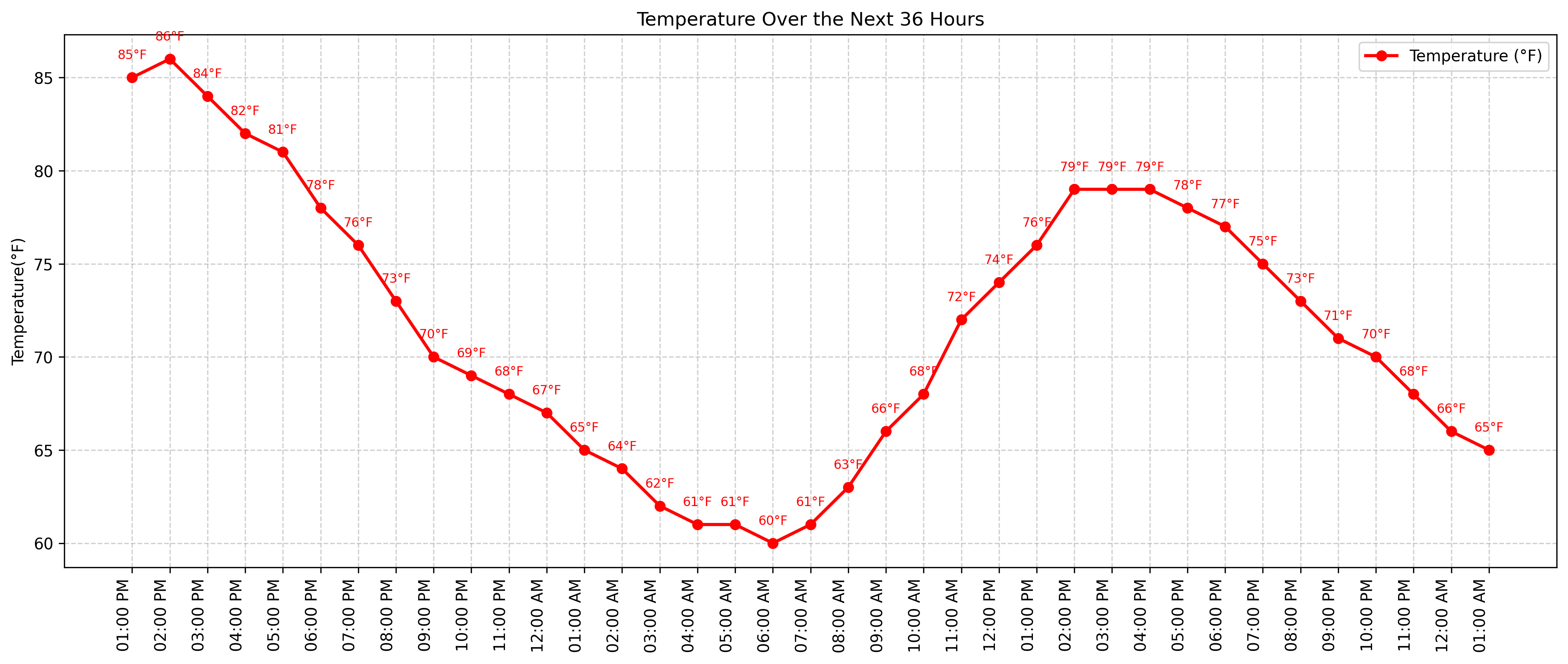
Monday will be cooler with highs near 80 in Denver. A few afternoon storms are possible, particularly across the southern foothills and into Park County, where some areas could pick up over an inch of rain. Tuesday and Wednesday warm up, with mostly dry conditions expected except for a few isolated mountain storms.
Looking ahead to the 4th of July, plan for scattered to possibly widespread thunderstorms in the afternoon and evening.
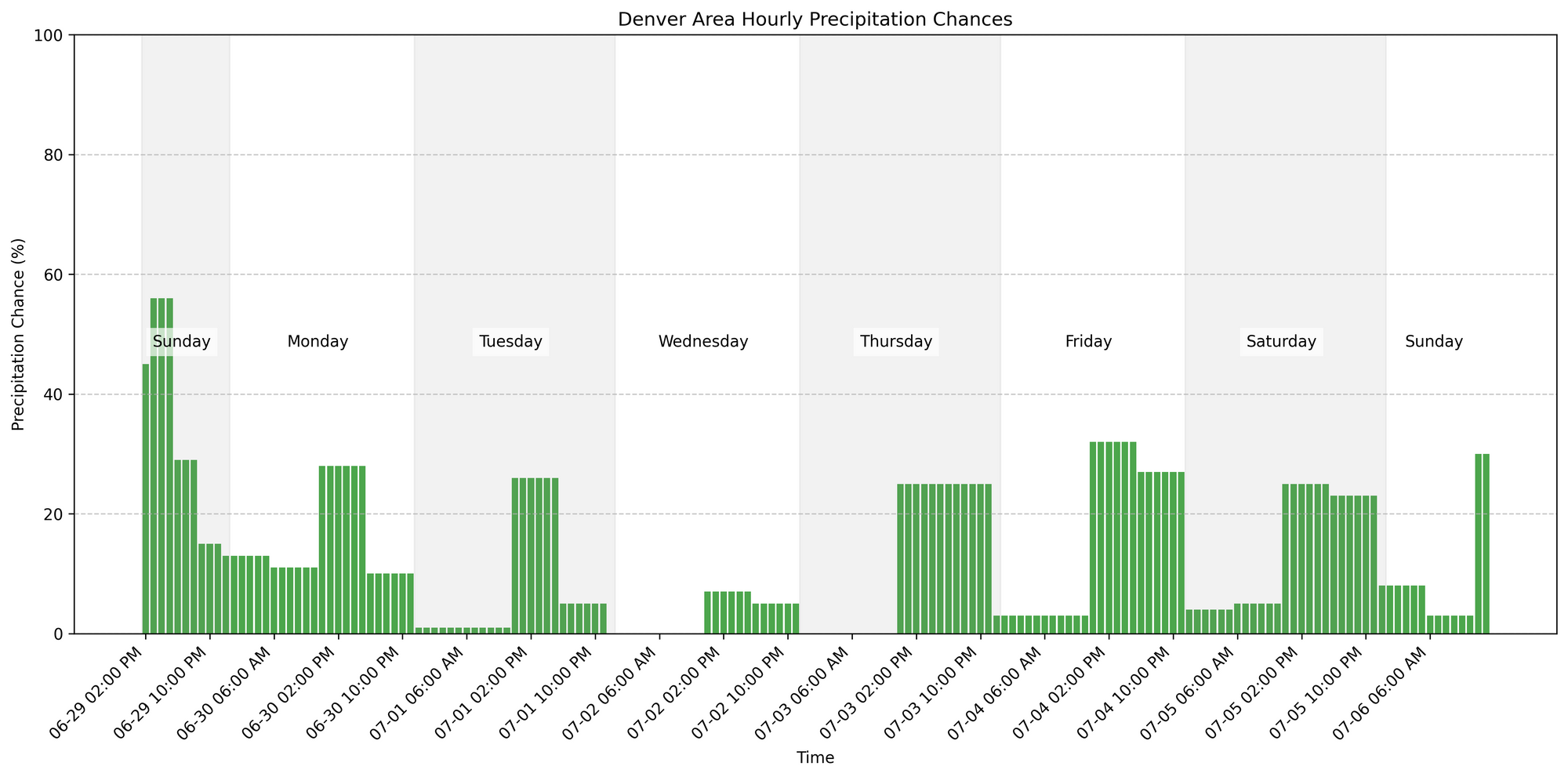
Moisture will be on the increase, and rain chances may ramp up just in time for fireworks plans.