It’s a summer weekend….filled with summery weather terms. Like a chance for thunderstorms. Some sticky air. And plenty of warm temps.
The sun is challenged today by lots of clouds.
We’ll still warm to the mid and upper 80s and there will be a noticeable amount of humidity (but not oppressive).

Severe, or strong storms this weekend? Watch for gusty winds, heavy rain, frequent lightning
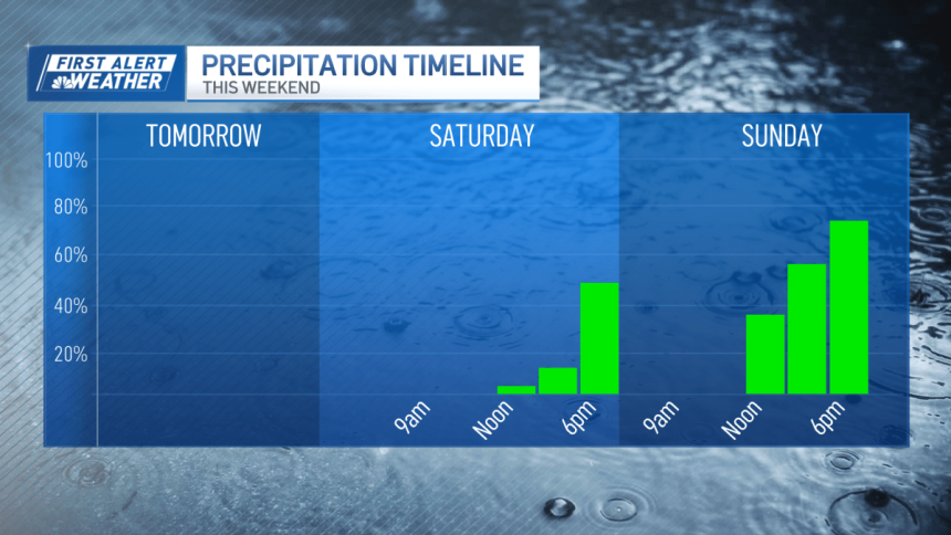
Storms are a solid bet in the late afternoon across western Massachusetts. Some of these will roam into central and eastern Mass. by late evening.
It’s going to be mostly 4 p.m. to 10 p.m. across the Greater Boston area.
While the storms may be severe to the west, they will likely weaken (but potentially be strong) as they arrive here. Watch for gusty winds, heavy rain and frequent lightning.
Weather radar
Weather alerts
Click here for any active weather alerts
Sunday weather
The tables turn on Sunday with more sunshine to start, then more afternoon clouds with a few showers popping up. These don’t seem widespread, but there may be a steady rain for an hour or two in some towns or cities. Highs are still in the 80s.
Next week’s forecast

Cooler air arrives Monday, along with lower humidity. This kicks off a fine stretch of weather through midweek. Our sole chance for storms will be on Thursday with a weak disturbance. Right now, next weekend’s weather looks hot…and rain-free.
Pollen
Pine pollen has peaked, and that “funny haze” you see drifting across the sky will lift over the next week.

Enjoy your weekend!